History The Niger Delta Region
Apart from Middle East, which has a long historiography of interminable crises, the Niger Delta Region, NDR, is the most studied Region of the world. It is not surprising that there is a repertoire of literature covering the various epochs of the Region. Part of the literature is written objectively to genuinely address the development challenges of the people while part of the literature was tilted to satisfy some sectional interests especially that of the oil majors. It is not surprising that measures put together as palliatives often pale into insignificance. Could this be the reason for the increase in the misery index, the resurgence of militancy, compounded by frustration, marginalization, alienation and poverty in the Region? Some analysts believe that the situation has been taken advantage of, by a band of self-serving benefit captors, economic opportunists, political adventurers and conflict entrepreneurs, all feasting on the honey pot of crude oil.
The predominant settlement type in the Niger Delta is small and scattered hamlets. The vast majority of settlements comprise largely rural communities in dispersed village settlements. In total, there are 13,329 settlements in the Niger Delta Region. Extrapolations from the 1991 National Population Census showed that at a growth rate of 2.9% the population of the Niger Delta Region by 2004 was about 30 million. Projected to 2015, it is expected that the population will be 41.5 million people.
| State | 2005 | 2010 | 2015 | 2020 |
|---|---|---|---|---|
|
Akwa Ibom |
3,343,000 |
3,895,000 |
4,537,000 |
5,285,000 |
|
Bayelsa |
1710,000 |
1,992,000 |
2,320,000 |
2,703,000 |
|
Cross River |
2,736,000 |
3,187,000 |
3,712,000
|
4,325,000
|
|
Delta |
3,594,000 |
4,186,000 |
4,877,000 |
5,681,000 |
|
Rivers |
4,858,000 |
5,659,000 |
6,592,000 |
7,679,000
|
|
Total |
28,856,000 |
33,616,000 |
39,157,000 |
45,715,000 |
Source: NDR Survey – Based on National Population Commission
The NDR is characterized by widespread poverty with about 70% of the population living below the poverty line. This might have increased in recent years when so many graduates have been turned out without jobs. The pervasive poverty is due largely to the low the level of industrialization. This has been made more difficult by the activities of Trans-national Corporations TNCs, which have adversely affected the traditional economy of subsistence fishing and farming. In the NDR infant mortality and maternal morbidity are estimated to be 20%, which is among the highest in the world. Modern transport infrastructure is inadequate and often hampered by a poor road network and harsh conditions especially in the coastal areas. Whereas there is hardly electricity supply in many riverine areas, telecommunication facilities are in acute short supply. Healthcare is less than desirable while the schools are ill-equipped hence they serve more as youth restive factories than institutions of learning. Waste management culture is poor and this is exacerbated by the activities of oil companies. These harsh conditions provide a fertile ground for social unrest, conflict and instability.
The exclusion of Niger Delta communities in the control and management of the upstream and downstream operations of the oil industry is disastrous to their very existence as a people. For instance, through the instrumentality of the Petroleum Act 1969 (as amended and other legislations), the local communities on whose lands oil is exploited, have been divested of their entitlements to their land and the oil produced from it. Indigenes of the Niger Delta hardly ever benefit from the allocation of Oil Prospecting Licenses (OPL) and are totally excluded from crude oil sales notwithstanding the fact that it is the local communities and the people that directly suffer from oil spillage, gas flaring, acid rain, and other forms of environmental degradation and pollution.
A Gallup Poll conducted on April 28, 2008 by Magali and Tortora (2008). The Poll showed that 61% of Nigerians think the inhabitants of the Niger Delta are suffering and 63% of the respondents believe the people of the Region have a right to protest, however, a vast majority of Nigerians reject pipelines vandalization, hostage taking and kidnapping of women and children as means of protest. Damnable as it may seem, some sympathizers of the insurgents describe the crisis as part of a global move by an oppressed class to fight for freedom and economic justice.
Perhaps the most disturbing aspect of the problems confronting the NDR is the myriad environmental hazards. The dangerous scenario was graphically captured in Article VI of the Kaiama Declaration:
“The un-abating damage done to our fragile natural environment and to the health of our people is due largely to uncontrolled exploration and exploitation of crude oil and natural gas, which has led to numerous spills, gas flaring, the opening up of our forests to loggers, indiscriminate canalizations, flooding, coastal erosion and earth tremors.”
The leader of the Niger Delta Volunteer Force: Dokubo Melford Goodhead aptly captured the situation thus:
“The Niger Delta is a conquered territory. It is a place of ruthless internal colonization; it is a place where the gun, the tanker, the battleship, and the marauding warplanes are always ready to deal destruction and death. The Niger Delta is the festering sore of the nation. The Niger Delta is a beggar by the roadside. The Niger Delta is a person raped and left for dead in a dark alley. It is a place of deepest sorrow”.
Generally, the familiar areas of crisis in the NDR bother on revenue allocation in terms of basis for equitable fiscal federalism; agitations pertaining to the creation of States and LGAs; boundary adjustments; key government appointments and the distribution of federal projects. All these challenges are exacerbated because of general governance failure.
Presently, Nigeria is reputed to be the sixth greatest oil producing country in the world. Nigeria is also an influential member of the Organization of Petroleum Exporting Countries (OPEC). Nigeria earns about 95% of her foreign exchange from crude oil and gas, and these resources are produced in the Niger Delta Region. The paradox is that the NDR is marginalized in addition to the burden of severe environmental degradation and their negative multipliers
The Niger Delta Development Commission, NDDC
The Willink Report of 1958 succinctly declared that the NDR are a group of independent and autonomous kingdoms and peoples, with separate languages, culture and religion, equal in status and in no way subordinate to one another but united as a corporate body to form the Federal Republic of Nigeria. The report also recommended that the Niger Delta be given special attention. This eventually led to the establishment of various interventionist agencies.
Following the Willink Commission Report of 1958, the Niger Delta Development Board, NDDB, was created in 1960. The Board did not create any impact until the 30-month fratricidal civil war. This was followed by the establishment of the Niger Delta Basin Development Authority (NDBDA). Like its predecessor agency, the NDBDA was under-funded in such a manner as not create any meaningful impact. Besides, the Federal Government created ten (10) other Basin Authorities and funded the others to the detriment the original one. The NDBDA was also emasculated by the Nigerian experience. The renewed agitations during the Second Republic led to the establishment in 1980, of the 1.5% Presidential Task Force. The Task Force could not create the desired impact because of poor funding. The Babangida regime in 1992 created the Oil Mineral Producing Development Areas Commission (OMPADEC), which was killed by the conspiracy of official highhandedness, under funding and lack of accountability.
The Niger Delta Development Commission is a Federal Government agency established by Nigerian president, Olusegun Obasanjo in the year 2000 with the sole mandate of developing the oil-rich Niger Delta region of southern Nigeria. In September 2008, President Umaru Yar’ Adua announced the formation of a Niger Delta Ministry, with the Niger Delta Development Commission to become a parastatal under the ministry.
The NDDC was created largely as a response to the demands of the population of the Niger Delta, a populous area inhabited by a diversity of minority ethnic groups. During the 1990s these ethnic groups, most notably the Ijaw and the Ogoni established organizations to confront the Nigerian government and multinational oil companies such as Shell. The minorities of the Niger Delta have continued to agitate and articulate demands for greater autonomy and control of the area’s petroleum resources. They justify their grievances by reference to the extensive environmental degradation and pollution from oil activities that have occurred in the region since the late 1950s. However, the minority communities of oil producing areas have received little or no currency from the oil industry and environmental remediation measures are limited and negligible. The region is highly underdeveloped and is poor even by Nigeria’s standards for quality of life. The Niger Delta Development Commission, NDDC is under-funded and there are genuine complaints about lack of internal accountability within the Commission. For the past 13 years of its existence, the Niger Delta Development Commission (NDDC) has achieved very little.
Sometimes violent confrontation with the state and oil companies, as well as with other communities has constrained oil production as disaffected youth or organizations deliberately disrupt oil operations in attempts to effect change. These disruptions have been extremely costly to the Nigerian oil industry, and both the multinationals and the federal government have vested interests in permitting uninterrupted extraction operations; the NDDC is a result of these concerns and is an attempt to satisfy the demands of the delta’s population.
The position of Executive Chairman of the NDDC has been a subject of much debate. A compromise was reached where the position would be rotated within the nine oil-producing states in alphabetical order: Abia, Akwa-Ibom, Bayelsa, Cross River, Delta, Edo, Imo, Ondo and Rivers.
Further, the Niger Delta, the delta of the Niger River in Nigeria, is a very densely populated region sometimes called the Oil Rivers because it was once a major producer of palm oil. The area was the British Oil Rivers Protectorate from 1885 until 1893, when it was expanded and became the Niger Coast Protectorate.
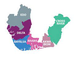
The Niger Delta, as now defined officially by the Nigerian government, extends over about 70,000 km and makes up 7.5% of Nigeria’s land mass. Historically and cartographically, it consists of present day Bayelsa, Delta, and Rivers States. In 2000, however, Obansanjo’s regime included Abia, Akwa-Ibom, Cross River State, Edo, Imo and Ondo States in the region. Some 31 million people of more than 40 ethnic groups are among the inhabitants in the Niger Delta, speaking about 250 different dialects.
The Niger Delta, and the “South South Zone”, which includes Akwa Ibom State, Bayelsa State, Cross River State, Delta State, Edo State and Rivers State are two different entities. While the Niger Delta is the oil producing region in Nigeria’s South South Zone a geo-political zone.
The delta is an oil-rich region, and has been the centre of international controversy over devastating pollution and ecocide, kleptocracy (notably by the Abacha regime), and human rights violations in which Royal Dutch Shell has been implicated.
Niger Delta Struggle
During the colonial period, the core Niger Delta was a part of eastern region of Nigeria, which came into being in 1951 (one of the three regions, and later one of the four regions). This region included the people from colonial Calabar and Ogoja divisions, which are the present Ogoja, Annang, Ibibio, Oron, the Efik people, the Ijaw, and the Ibo people, as the majority and the NCNC (National Council of Nigeria and Cameroon) as the ruling political party in the region. NCNC later became National Convention of Nigerian Citizens, after western Cameroon decided to separate from Nigeria. The ruling party of eastern Nigeria did not seek to preclude the separation and even encouraged it.
In 1953, the old eastern region had a major crisis due to the expulsion of Professor Eyo Ita from office by the majority Igbo tribe of the old eastern region. Eyo Ita from Calabar was one of the pioneer nationalists for Nigerian independence. He was an Efik man. The minorities in the region, the Ibibio, Annang, Efik, Ijaw and Ogoja, demanded a state of their own, the Calabar-Ogoja-Rivers (COR) state. The struggle for the creation of COR state continued and was a major issue on the status of minorities in Nigeria during debates in Europe for Nigerian independence.
In 1961, another major crisis occurred in the eastern region of Nigeria when the leadership of the region allowed the present South western Cameroon to separate from Nigeria (Akwa Ibom and Cross River) through a plebiscite while the leadership of the then Northern Region did what they had to do to keep North western Cameroon in Nigeria that is the present day Adamawa and Taraba States. Without the 1961 plebiscite, Nigeria would not have the current problem with Cameroon about Bakassi, as Bakassi would have been an interior part of Nigerian (Akwa Ibom and Cross River) territory.
A second phase of the struggle saw the declaration of an Independent Niger Delta Republic by Isaac Adaka Boro during Ironsi’s administration, just before the Nigerian Civil War. During the Nigerian civil war, South Eastern State of Nigeria was created (also known as South Eastern Nigeria or Coastal South Eastern Nigeria), which had the colonial Calabar division, and colonial Ogoja division. Rivers State was also created. South eastern state and River state became two states for the minorities of the old eastern region, and the majority Igbo of the old eastern region had a state called East Central state. South eastern state was renamed Cross River state and was later split into Cross River state and Akwa Ibom state. Rivers state was later divided into Rivers state and Bayelsa state.
Phase three saw the request for justice and the end of marginalization of the area by the Nigerian government with Ken Saro Wiwa as the lead figure for this phase of the struggle. The indigents cried for lack of development even though the Nigerian oil money is from the area. They also complained about environmental pollution and destruction of their land and rivers by oil companies. Ken Saro Wiwa and other leaders were killed by the Nigerian Federal Government under Sani Abacha.
Unfortunately, the struggle got out of control, and the phase four, became militant. The President and Commander in Chief of the Armed forces of Nigeria, Alhaji Umaru Musa Yar’Adua GCFR, on June 25, 2009, proclaimed a 60 day unconditional amnesty period for militants in the Niger Delta, as a step towards resolving the protracted conflict in the region. The terms of the Amnesty include the willingness and readiness of the militants to surrender their arms, unconditionally renounce militancy and sign an undertaking to this effect.
In return, the government pledged its commitment to institute programmes to assist their disarmament, demobilization, rehabilitation and provision of reintegration assistance to the militants.
Western (or Northern) Niger Delta
Western Niger Delta consists of the western section of the coastal South-South Nigeria which includes Delta, and the southernmost parts of Edo State. The western (or Northern) Niger Delta is an heterogeneous society with several ethnic groups including the Urhobo, Delta Ibo, Isoko, Itsekiri, Ijaw (or Ezon) and Ukwuani groups in Delta State. Their livelihoods are primarily based on fishing and farming. History has it that the Western Niger was controlled by chiefs of the five primary ethnic groups the Itsekiri, Isoko, Ukwuani, Ijaw and Urhobo with whom the British government had to sign separate “Treaties of Protection” in their formation of “Protectorates” that later became southern Nigeria.
Central Niger Delta
Central Niger Delta consists of the central section of the coastal South-South Nigeria which includes Bayelsa and Rivers States. The Central Niger Delta region has the Ijaw (including the Nembe-Brass, Ogbia, Kalabari, Ibanis (Opobo, Bonny,etc.), Okrika, and Andoni clans, the Ogoni and other groups which consist of the Ekpeye, Ndoni, Etche, Ikwerre and Ndoki in Rivers State.
Eastern Niger Delta
Eastern Niger Delta Section consists of the Eastern (or Atlantic) section of the coastal South-South Nigeria which includes Akwa Ibom and Cross River States. The Eastern Niger Delta region has the Efik, Ibibio, Annang, Oron, Ogoja (including Ekoi and Bekwara) people, who are all related with a common language and ancestor.
Nigerian Oil
Nigeria has become Africa’s biggest producer of petroleum. Some 2 million barrels (320,000 m3) a day are extracted in the Niger Delta. First oil operations in the region originated in 1950s and were undertaken by Multinational Corporations, which provided Nigeria with necessary technological and financial resources to extract oil. Since 1975, the region has accounted for more than 75% of Nigeria’s export earnings. Together oil and natural gas extraction comprise “97 per cent of Nigeria’s foreign exchange revenues”. Much of the natural gas extracted in oil wells in the Delta is immediately burned, or flared, into the air at a rate of approximately 70 million m³ per day. This is equivalent to 41% of African natural gas consumption, and forms the largest single source of greenhouse gas emissions on the planet.
The biggest gas flaring company is the Shell Petroleum Development Company of Nigeria Ltd, a joint venture that is majority owned by the Nigerian government. In Nigeria, despite regulations introduced 20 years ago to outlaw the practice, most associated gas is flared, causing local pollution and contributing to climate change. The environmental devastation associated with the industry and the lack of distribution of oil wealth have been the source and/or key aggravating factors of numerous environmental movements and inter-ethnic conflicts in the region, including recent guerrilla activity by the Movement for the Emancipation of the Niger Delta (MEND).
In September 2012 Eland Oil & Gas purchased a 45% interest in OML 40, with its partner Starcrest Energy Nigeria Limited, from the Shell Group. They intend to re-commission the existing infrastructure and restart existing wells to re-commence production at an initial gross rate of 2,500 bpd with a target to grow gross production to 50,000 bpd within four years.
Oil Revenue Derivation
Oil revenue allocation has been the subject of much contention well before Nigeria gained its independence. Allocations have varied from as much as 50%, owing to the First Republic’s high degree of regional autonomy, and as low as 10% during the military dictatorships. This is the table below
| Year | Federal | State * | Local | Special Projects | Derivation Formula ** |
|---|---|---|---|---|---|
|
1958 |
40% |
60% |
0% |
0% |
50% |
|
1968 |
80% |
20% |
0% |
0% |
10% |
|
1977 |
75% |
22% |
3%
|
0%
|
10%
|
|
1982 |
55% |
32.5% |
10% |
2.5% |
10% |
|
1989 |
50% |
24% |
15% |
11% |
10% |
|
1995 |
48.5% |
24% |
20% |
7.5% |
13% |
|
2001 |
48.5% |
24% |
20% |
7.5% |
13% |
*State allocations are based on 5 criteria: equality (equal shares per state), population, social development, land mass, and revenue generation.
**The derivation formula refers to the percentage of the revenue, oil producing states retain from taxes on oil and other natural resources produced in the state.
History of Akwa Ibom State
The Ibibios with the Efiks migrated down the Cross River during the first half of the 17th century and founded Creek Town, Duke Town, and other settlements including Calabar. Calabar developed into a major trading centre from the 17th to the 19th century, exporting palm oil in return for European goods.
After the chiefs of Duke Town accepted British protection in 1884, the town, which was called Old Calabar until 1904, served as capital of the Oil Rivers Protectorate (1885–93), the Niger Coast Protectorate (1893–1900), and Southern Nigeria (1900–06) until the British Administrative Headquarters were moved to Lagos. It remained an important Port (Shipping Ivory, Timber, and Beeswax, as well as Palm Produce) until it was eclipsed by Port Harcourt, terminus (1916) of the railroad, 90 miles (145 km) West.
On September 23, 1987 the South-western third of Cross River State got created as a new state called Akwa Ibom State. Thus, Akwa Ibom was created by combining the Uyo, Ikot Ekpene, Eket and Abak divisions of old Calabar Province.
The Ibibio State Union
In 1928, the formation and formal inauguration of the Ibibio State Union took place. In 1948, the Union transformed from a mere progressive cultural association to a meaningful national institution, which engaged itself in the propagation and promotion of the noble cause of the creation of states in Nigeria based on the concept of Nigeria as a Federation of States.
The agitation for the creation of a separate state for minority groups in the former eastern region was heightened in 1953 with the passing of a vote of no confidence on the Eyo Ita government and the subsequent formation of the United National Independence Party (UNIP) made up mainly of the non-Igbo speaking people of the region.
It was this party as official opposition party in the reconstituted Eastern House of Assembly that first demanded for the creation of the Calabar-Ogoja-River (COR) State for the minority groups of the region. The agitation for state creation later spread to the minority ethnic groups in the country. The increased agitation by various ethnic groups was subsequently discussed at the London Constitutional Conference of 1957 and a case for the creation of State for the minority groups in the country was established.
Trade Route & Missionary Contact
What is now Akwa Ibom became a trade route supporting other trading centres, mainly Calabar. This can be observed from the existence of various European trading warehouses.
Most importantly it was a major trade route particular during the era of slave trade (1503 – 1842) and a cradle of European Christian Missionary contact with people in hinterlands (1846 – 1900) at the beginning of the 20th century, seen in the early missionary presence of the Qua Iboe Mission established by Rev. Samuel Bill in 1912 at Ibeno and Etinan, followed by other missions like the Church of Scotland Mission, and the Roman Catholic Missions
Oil Rivers Protectorate to Southern Nigeria
After the chiefs of Duke Town accepted British protection in 1884, the town, which was called Old Calabar until 1904, served as capital of the Oil Rivers Protectorate (1885–93), the Niger Coast Protectorate (1893–1900), and Southern Nigeria (1900–06). Southern Nigeria’s administration was under Queen Victoria. The Queen was soon succeeded by her son, King Edward VII in 1903 until the British administrative headquarters were moved to Lagos. In 1916 Lord Frederick Luggard promoted indirect rule and unified Southern and Northern Protectorates into one country, Nigeria.
Calabar remained an important port (Shipping ivory, Timber, and Beeswax, as well as Palm produce) until it was eclipsed by Port Harcourt, terminus (1916) of the railroad, 90 miles (145 km) West.
Accessibility Factors
The completion of roads from Calabar to Arochukwu, Ikom, and Mamfe (in Cameroon) and the Calabar–Itu–Ikot Expene highway (which provides easy access to the rest of Nigeria) has contributed to Calabar’s importance as a port.
Calabar has long been an educational centre. Its first church school established by the Reverend Hope Waddell of the Free Church of Scotland in 1846, helped influence the Ekpe secret society to pass a law (1850) prohibiting human sacrifice.
Commodity trade continued to flourish even with Luggard’s successor, Hugh Clifford (1919-25), who was concerned with introduction of practical benefits of Western experience. Clifford emphasized economic development, encouraging enterprises by immigrant southerners in the north while restricting European participation to capital intensive activity.
What is now Cross River state was part of the former Eastern region until 1967, when it became South-Eastern state and renamed Cross River state in 1976.
Agitation for a New State
In 1967, the struggle for state creation by the Ibibio State Union yielded fruit in the creation of states in Nigeria by the General Yakubu Gowon administration. The South Eastern State of which the present day Akwa Ibom formed a part was one of those states.
During the General Murtala Muhammed administration, seven additional states were created in 1976. The South Eastern State was then re-named Cross River State. The change in name, however, did not assuage the agitation of the people. The struggle continued.
After the collapse of the 2nd Republic in 1983, a memorandum demanding the creation of Akwa Ibom State was submitted to the General Buhari Military administration by Paramount Rulers from six local government areas of the “Mainland” part of the former Cross River State. Still, nothing happened. When the Political Bureau set up in 1986 by the Federal Military Government called for memoranda from the public on how Nigeria could be governed, the people once again, seized the opportunity to resubmit their memorandum for the creation of Akwa Ibom State.
1987 Creation
On September 23, 1987 with the promulgation of Degree 24 of that year by the then military President, Commander-in-Chief of the Armed Forces of the Federal Republic of Nigeria, General Ibrahim Badamasi Babangida, the South-western third of Cross River state was created as a new state called Akwa Ibom State. Thus, Akwa Ibom was created by combining the Uyo, Ikot Ekpene, Eket and Abak divisions of old Calabar Province. Consequently, General Babangida appointed Tunde Ogbeha as the first Governor of the state. Tunde Ogbehia ruled the state from 23 Sept., 1987 to 30 July, 1988.
By all accounts and considerations, the creation of Akwa Ibom State has been a dream come true and the yearnings of people fulfilled. Its people have continued to cherish the euphoria, which greeted that first proclamation. And since then, they have risen to the challenges attendant, upon their new political identity, embarking vigorously on capital projects to ensure a prosperous state and a ‘Land of Promise’ which will serve as a model in Nigeria.
Government
There are 31 Local Government areas in the state with Ikot Ekpene, the oldest local government area in Nigeria created in 1951, as one of them. Others are: Abak, Eket, Ekpe, Atai, Essien Udim, Etinan, Etim Ekpo, Ikono, Ikot Abasi, Ini, Itu, Mbo, Mkpat Enin, Nsit Ibom, Nsit Ubium, Okobo, Onna, Oron, Oruk Anam, Ukanafun, Uquo Ibeno, Uruan, Urue Offong/Oruko, Uyo, Obot Akara, Ibesikpo Asutan, Ibiono Ibom, Eastern Obolo, Udung Uko, Ika, and Ibeno.
Administrative Structure
Akwa Ibom Government is comprised of three equal and independent branches, the Executive, Legislative and Judiciary. The Executive branch administers the Laws through organs of the executive council, ministries, agencies and Local Government and is overseen by the Government. The Legislative makes law, the responsibility carried out by the 26-member House of Assembly headed by the Speaker. And the Judicial branch headed by the Chief Judge preserves the rule of law by resolving dispute through the court.
The Executive Branch
The Executive branch of Akwa Ibom State Government has the Governor, Deputy Government and all Cabinet members. The Governor is allowed to pass or veto a bill that the legislative sends him. His assent is required for all bill passed by the House of Assembly before they can become one.
The Executive conducts the Government deciding on policy and administering legislation. All-important Government policy decision and Legislative proposals either come from or are agreed to by cabinet. Cabinet also coordinate the activities of Commissioners. Cabinet consist of Commissioner appointed by the Governor. These Commissioners are usually responsible for one or more Government departments supervised by permanent Secretaries.
The Legislative Branch
Akwa Ibom State legislature has a chamber called the House of Assembly. 26 members are elected by citizens from across the State for the four-year term to represent them. The House responsibilities are to debate about legislations, provide a Government, supervised the Government administration that requires it to explain policies and action, supply funds and represent the views of the people of Akwa Ibom State. It has a number of selected committees, which examines proposed legislation (Bill) in detail, often bearing submission from interested members of the public.
The Judicial Branch
The Judiciary explains and applies the laws. This branch does this by hearing and eventually making decisions on various legal cases. The Judicial branch is in charge of the court system. There are three different courts, the Magistrate court, the high court and the court of appeal. Although there are special court for such cases as environmental and revenue matters. Judges are appointed by the Governor. The Judges apply the law to every case that comes before the court. Akwa Ibom State Judiciary is independent and free from political interference.
Ministries
Akwa Ibom State Ministries are Government’s Departments for sectoral service delivery by the Executive branch of the State Government.
Most Ministries are housed in the Idongesit Nkanga’s Secretariat Complex. Each Ministry is headed by a Commissioner appointed by the Governor. The Commissioners work with the permanent Secretaries and directors of the ministries. The Staff of the Ministries are civil service employees headed by the head of Civil Service.
The Ministries are created to service needs of the citizens such as social, economic and environmental securities. These Ministries provide such needs as Education, Health, Housing, and Lands among others.
Akwa Ibom State Local Government support grass root participation in Government and ensures developments at the local level and the rural areas of the State. The Local Government are overseen by an appointed Commissioner for local Government and Chieftaincy affairs, which oversees elected Local Government Chairmen and paramount rulers.
Local Government
The Local Government chairman of the 31 Local Government areas of the State, together with their vice chairmen, council legislatives and councillors operate from their respective secretariats managing schools, hospitals, markets and other people-oriented infrastructures and services. The Paramount rulers with their clan heads, village heads and chiefs operate from their palaces in each local government areas delivering community-based leadership.
SOCIAL INFRASTRUCTURE
Entertainment
Akwa Ibom State is a rich entertainment destination where guests persist their enjoyment in the mind much longer after each experience. Over the years the people’s heritage have developed into a sharable treasure with contemporary and traditional music rich in meaning arousing to the senses and rendered with our supporting culture.
Our dancers are not just talented, they are genius in the act and you can feel the world move with their dance steps. There are several dance troupes where dancing speaks and plays.
Being an amusing people, there are various comedians to deliver double barrel nonstop laughter with stories so exotic to extend laughter beyond the gates.
With the coming on stream of the Tropicanna entertainment centre latest pictures will enjoy being premiered right in Uyo so our guests don’t miss a thing away from home.
Hotels
Hotels in Akwa Ibom provide a gladdening stay for guests. At very affordable rates they provide delightful facilities and packages to make them a home away from home. They are hotels for every pocket, and for various kinds of visit. Whichever you choose, you still get the legendary Akwa Ibom hospitality.
We have transient, resort, and residential hotels. The transient hotels provide room with private bath, telephone, cable television, as well as customer services such as laundry, cleaning, pressing, nightclub, restaurant, cocktail lounge, and gift shop. The resort hotels provide a more luxurious stay with facilities and special attractions targeted at vacationers. Such facilities include water sports and health spa. The residential hotels offer room service in addition.
Most of our hotels operate on the European plan where tariffs cover only the room and guests make their own arrangements for meals and services except for resort packages, which come seasonally.
Tourism
Akwa Ibom is a rich tourism destination offering unrivalled wealth of scenic landscape, long sandy coast, a wealth of wildlife and culture, plus a warm and friendly people, known for their exceptional culinary skills. Solidly wedged in Nigeria’s South Eastern flank, the state is deeply religious and this shows not only in its name which translates into The Great God of Heaven, but also in the rich relics of its traditional religion which have been preserved across the state. The local dances, songs, folklore, mythology, cult and traditional festivals provide engaging opportunities for those who seek naked excitement and unspoilt pleasure.
Ibeno sand Beach famous for yachting and swimming, Oron Museum – collection of finest carvings in Africa, Opobo Boatyard. Natural sand Beaches at Ikot Abasi.
Akwa Ibom State is uni-cultural where the mores, taboos, customs and traditions are basically the same. Similarly, the state is blessed with that there is no language barrier among the three ethnic groups as Ibibio is spoken and understood among all linguistic groups. But officially, English is spoken.
Tourist Sites
Whenever Tourism is discussed, the abundant evidence of Tourism potentials of Akwa Ibom State leads to the conclusion that, here is a pleasure and leisure latent pasture. Imagine a community at the bank of the Atlantic Ocean where there is sea-brewed fresh breeze sifted through unpolluted foliage of dense Mangrove forest to savour, or an amazing stretch of over 120 kilometres sand bank that transverses many Riverine Communities, or an ocean shore to cruise at ebb tide and the rhythmical music of the waves, providing tourists with exotic sites.
Museum and Monument
Museums, historic sites and monuments dot the entire landscape of Akwa Ibom State. This is evidence of the people’s enormous cultural vitality and capacity for immediate response to facing new challenges. There are Stone Age, Metal-Smelting Sites, Bronze and Terracotta Figurines, Ancient Farming and Fishing Settlements and Sites of Abandoned Village Playgrounds, Sacred Groves and Shrines.
There are three museums in Akwa Ibom State, which hold the relics of ethnic works of arts and history of the cultural heritage of the people of Akwa Ibom State. The museums are located in Uyo, Oron and Ikot Udo Essang in Onna Local Government of the State.
There is also the traditional centres of religious ritual and group dispersal like the famous Akwa Akpa Island, Ibom and Asan Ibibio, Afaha Nsit and Obio Ibiono and early settlement sites at Enwang, Ididep, Ishiet and Inua Akpa, Otoro and Esuk Oro with legendary landing beaches, pre- colonial water routes that leads to the ancient river beach market which agricultural produce, crafts, slave-trading goods, palm produce were transacted. The Portuguese and Aro Slave trading outposts and occasional troves of old manila currency still litter the hinterland of the state.
In addition to these are; the abandoned landing jetties, prefabricated buildings and warehouses from the flourishing oil palm trade, a mark of the state being an oil-palm heartland which brought economic prosperity and opened the region to civilization. Akwa Ibom state as a land of historical landscapes is evidenced by the various pre-colonial and colonial landscapes and legacies in all parts of the state including slave trade routes, slave warehouses, dungeons and slave master’s lodges.
Oron National Museum & Beach
At the beautiful river bank next to the old trade beach from which land boats carry cargoes from upriver area of the Niger delta coast towards Cross River, Cameroon and Fernando Po stands the Oron Museum, encapsulated by the clear flowing waters of the Oron River.
The Museum was established by K.C Murray in 1959 as a treasure house for the preservation of several hundred Ekpu Oro (ancestral spirits of Oron), wood carvings believed to be the oldest and finest wooden sculptures in Africa, which were preserved at the decaying ancestral shrines in the town. Apart from the Ekpu carvings, the museum is also the home of unique skin- covered and horned head masks; the powerful Obasi Njom masquerade from upper Cross River area, old manilla currency, water spirit masquerade relics, traditional raffia and metal works, the traditional pottery and provide a visitor with a cultural voyage into the world of creativity. By its location, it offers both recreational and aesthetic facilities to tourists with its sprawling river and beach view.
Uyo Museum
The Museum at Uyo preserves all the relics of the Military Administration of the State as well as the State’s heritage of arts and culture. It is located at the Wellington Bassey Way end of Governor’s Office.
The Uyo Museum is another tourist site to behold. It is an embodiment of the historic relics of the state. It also contains cultural artefacts and administrative offices used by both the colonial and post-colonial administrators of the state. The museum, which stands on undulating landscape bordered by the captivating ravine presents a beautiful scenery and serenity. Surrounded by greenish courts and lined on either side by whispering pines and fruit trees it presents a monument that is close to nature.
Cenotaph of the Women War of 1929
Women of Ikot Abasi, then a part of Opobo were actively involved in the famous women riot of 1929 over taxation and in protest against colonial rule, which culminated into the Aba Women riot of 1929. It was alleged that the protest was as a result of the new tax regime introduced by colonial officials in the then Eastern Nigeria.
Women protesting against their inclusion in the head tax mobilized themselves from all parts of the region, some coming in canoes singing and chanting. On landing at the colonial administrative office they started chanting war songs. To quell the riot, the British officials asked the colonial police to open fire on the singing unarmed women, which led to the death of scores of women.
To commemorate the bravery of these women who stood their ground and died for a just cause, a statue was erected in front of the Ikot Abasi Local Government secretariat, which was then the administrative headquarters of the British colonial government. On every December 16, each year all Akwa Ibom women gather at the sight to commemorate the selfless sacrifice of these women.
The Slave Dungeons and the Bridge of No Return
At the bank of the Imo River estuary, a walking distance from the Amalgamation house and colonial offices is a jetty and a bridge designed to enable free movement to and from the river, to enable embankment into boats and canoes. This was the famous Bridge of No Return, a name given to it by the locals. Slaves were walked down this bridge to the canoes for onward movement to the slave ships that lay anchored at the middle of the high sea waiting for their human cargoes for onward journey through the Atlantic Ocean to the vast plantations in Europe and Americas. No slave that walks down the bridge ever returns and this informed the name “Bridge of No Return”.
Also at this bridge are the slave dungeons made up of containers of cast concrete with two tiny holes at each end to enable occupants receive air. This is where the most stubborn slaves were kept before shipment for the purpose of weakening their resolve. The Dungeons have partitions, so that each cubicle holds one slave. Apart from the dungeons, there are warehouses for goods that were later turned into slave warehouses. This was where the slaves were kept in preparation for their shipment.
Amalgamation House
Off the road from the hall of fame is the house in which Lord Lugard the colonial governor of Northern Nigeria Amalgamated the Northern and Southern Protectorates in 1914, making Nigeria one geographical entity. It was also in this historical edifice, which continues today to serve as an administrative office in Ikot Abasi Local Government, that General Olusegun Obasanjo the commanding officer of the Nigerian Army and General Phillip Effiong in January 1970 signed and declared a cease-fire that brought the Nigerian-Biafran civil war to an end.
Originally, the building itself belonged to the Royal Niger Company, the merchant traders who were given the Royal Charter to govern Nigeria on behalf of the British crown till 1900. This building served as their administrative headquarters. The building stands on short concrete pillars with brick walls and hardwood. Its corrugated iron roof sheets are still intact to this day.
Mary Slessor’s Residence & Office
The present Government Secondary School at Ikot Obong, Ibiono Local Government Area is a remodelled version of the Old mission school built by Mary Slessor in the late 19th century to cater for the educational needs of the indigent children. The old structures have been combined with new ones but the old walls are as strong as they were built. Within the school premises are the ruins of Mary Slessor’s former office.
The concrete steps leading to the office and her safe which recently was moved by the Presbyterian Church for safe keeping are still intact. Behind the school premises, one can find the ruins of the house where Mary Slessor lived for many years. Her water tank and the concrete foundations of the house are all that remain of this historical monument, as the house being made of clay has long been destroyed by the elements. It was in this site that Mary Slessor died in 1915, and from where her body was moved to Calabar, the then capital of the region for burial.
Onna Museum
The museum at Ikot Udo Essang in Onna Local Government Area has personal collections of Cross ethnic works of arts and ethnographic, numismatic, traditional royal regalia of late Chief (Dr.) Clement Nyong Isong, the first Nigerian Central Bank Governor and first Civilian Governor of Cross River State before the creation of Akwa Ibom State which he donated to his State of origin. The museum and monument are available for research, for both youths and adults.
Government Hills, Itu
The “Government Hills” at Itu, Uyo and Abak, which till date retains the feature of 20th century colonial administrative centres complete with the mangos and pear tree that are silent witnesses to the historical events and personalities that shaped the history of the era. This is also reflected in the local street names like Barrack road, hospital road, Brooks street, Liverpool street etc.
Luggard’s House
Opposite the Amalgamation house is the one-storey cottage, where Lord Lugard lived during the amalgamation period. It is said that the site was the first administrative headquarters of the region before it was relocated to Calabar.
Apart from the solid structure that is still comparable with modern structures, there were several colonial buildings in this area that served as courts, offices, residential houses and recreational centres. All these facilities are still intact as when they were built. One significant historical fact is that the area is situated at the bank of Imo River estuary, a tributary from where King Jaja of Opobo was shipped into exile.
Slave Master’s Lodge and Warehouse
The Itu River was a renowned slave trade route and the old jetty still stands. There are a number of old prison-like warehouses where slaves were kept to await shipment via the Itu River. The main lodge was the residence of the white slave merchants who occupied the area. This is a one-story house, much complex and beautifully constructed.
Mary Slessor’s Cabin
This is a monument erected on the site of the home built by Mary Slessor “the white Queen of Okoyong” as a shelter for twins and their mothers, whom she rescued from the evil forest, where they were cast away. The floor of the old house is still intact and there is a long column of steps leading up to the site, which is located on top of the Okoyong Hill.
Qua Iboe Church
The Qua Iboe Church architecture at Atan Offot, Uyo, which still stands in its aesthetic splendour, is a relic representing the missionary zeal of self-supporting efforts of the people. The church was built through the efforts of local workers and contributions made by the people to ensure that evangelization along the Qua Iboe river basin and beyond was accomplished.
Royal Niger Boot Yard
The boat yard is found after Lugard’s house, behind the administrative building of the former Royal Niger Company premises. It is a large boar yard, where merchant ships were built and repaired. There exist some old boats and canoes of all sizes in the yard, which is an indication of the extensive businesses carried out in the area in the past.
Hall of Fame
This is another monument built in remembrance of the brave women who were killed in the 1929 women riot at the consular beach, Egwang Opobo now Ikot Abasi and elsewhere in the State. The commemorative marble plaque inside the building contains names of twenty-three women that died at Ikot Abasi; three that died at Etim Ekpo and another thirty-three at Abak. Also listed alongside their names are the names of their towns of origin, which on close examination shows, they came from all over the former Eastern Region and Niger Delta areas.
Abandoned Settlement
These include old battle grounds at Esuk Odu, Ibiaku Uruan, Ekpene Ukim, Okat and Ikot Ibiok (Eket) and abandoned settlement sites of the obliterate five-mile-radius Ubuim settlement twice burnt down and the 17 destroyed Qua Iboe villages, all bore memory of resistance of the people against colonial rule. Local stories described the battles as unequal, a battle of men and women with bare hands and songs against machine gun of numerous military and punitive expeditions.
WILDLIFE
For eco-tourists, Akwa Ibom is rich in various species of animal and bird life to make a memorable trip. Watch rare species of African fauna, elephants, leopards, rhino, antelope and different types of monkeys, birds and fishes in their natural habitat at the coastal and inland forest games reserves at Mbo/ Uquo, Ibeno Local Government.
The area offer amazing opportunities for bird watching, ocean of fresh water fishing, insect collecting and animal husbandry of unusual wool less sheep, small hunch – backed cattle, land snails and a variety of crayfish, prawns, clamps, crabs and lobsters.
A conservation programme is going on here to preserve endangered species of flora and fauna under national and international conservation programmes.
Festival Calendar
FESTIVAL | SIGNIFICANCE | MONTH |
Ekpiri Akata | This is a public outing meant to expose anti- social behaviours through songs sung mainly at night by masked performers. It is common in Itu and Uruan | January – March |
Mbre Mmong | This is a biannual aquatic festival connected with a fertility cult and ancestral worship in Nsit Ubium. The celebration is accompanied by a Boat regatta. | Mid-January- Mid- March |
Usoro Ubine Ikot | It is a- hunting expedition and lifting of sanctions on seven-year fallow farmlands for cultivation in Ikono- Ndiya | February/ March |
Ekpe Outings | A feast for protection of farm crops and domestic animals. They are displayed by beautiful masquerades. It is celebrated by Uruan and Oron people | March/early April |
Ekong Festival | An entertainment festival that witnesses the display of colourful masquerades. It is meant to re-establish peace, love and order and to publicly disgrace transgressors. | Mid-June – End of September |
Feast of Etefia Deity | A clan celebration of appeasement and thanksgiving to the communal deity of Uyo, Ikono and people in Ini Local Government Areas. | July / August |
New Yam Festival | A thanksgiving feast to the gods and ancestors for yam harvest in Ikot Ekpene, Ikono, Nsit Ubium, Ibino etc. | July / August |
Usoro Abasi | Thanksgiving and appeasement of the communal gods before the celebration of the New Yam in Ikono | August |
Feast of Anyan | For appeasement of the communal deity of Otoro clan in Ikot Ekpene. | July / August |
Eset (Ise) Feast | A feast to pay tribute to the warriors in Ukana Clan. | July / August |
Iso Awa-Itam feast | A thanksgiving and appeasement celebration to the deity of Awa Itam. An occasion to mark clan re- union | July, August / December |
Atakpo festival | Annual feast and ritual worship in honour of Uruan clan deity. It is accompanied by masquerade displays and merry making | Aug. / Sept. |
Ikon (Melon)Festival and Ebre (water yam festival) | Thanksgiving for a good year’s harvest of melon and water yam accompanied by dances and music. | Aug. / Sept. |
Ekong Nkemba | Annual celebration in honour of the ancestors of Idu, Uruan and Mbiakong people. | August |
Usoro Ekpo | In remembrance of the ancestors and gods of the land. A full month’s celebration, this feast is associated with the Ikot Abasi, Mkpat Enin, Ibibio and Annang peoples. | August |
Obodom Eyong (Drum in the Sky festival) | A thanksgiving ritual to the gods performed once every seven years, in Ikono and Afaha Obong | November |
Nkuku Atan | Period of appeasement and thanksgiving to the gods and communal deity by Ibiakpan clan in Nsit Ubium. | November |
Nkim-Eyong festival | Biannual feast for the appeasement of the gods and ancestors during the time of harvest at Idu- Uruan | November / December |
Mbok and Nkwobo | Traditional wrestling festival celebration organized to commemorate the outing ceremony of young maidens in Oron /Oruku areas. | December |
Oko festival | This is a burial or coronation celebration of chiefs, and great warriors of Adiasim community | No particular time |
Mfuuho | A State festival of masquerades privately organized annually | December |
Education
In Akwa Ibom State, premium is placed on Education as a way of empowering the future generation. The higher institutions in the state are funded by both State and Federal government. These are:
University of Uyo
Akwa Ibom State University of Technology
Akwa Ibom State Polytechnic
College of Education
Afaha Nsit, Obong University.
Education at Primary and secondary schools is free and compulsory for the protection of child rights; this has led to increased enrolments. Government also awards scholarships to various levels of students of higher institutions.
The targeted education strategy involves capacity building and empowerment that moves technology and science-based professionals into vital sectors to meet challenges of a modern economy so as to fight unemployment and assure adequate supply of skilled manpower. Further, these professionals as specialists in their respective fields become able to manage themselves as a business unit or become highly employable.
Health
Akwa Ibom with a population of 3.9 million and 31 local government areas takes the health of her citizens serious. The state implements a care delivery system through a two-pronged integrated primary health care services and secondary health care strategies. The integrated primary healthcare services are deployed to carry out preventive health care measures, health education, maternal care, infant and child care and immunizations, mass screening social work and environmental and occupational health. On the huge scar HIV/AIDS has left on humanity, the state has deployed an action plan to fight the scourge, by establishing 18 Centres for the prevention of Mother – to- Child HIV/AIDS transmission and 47 HIV/AIDS Testing and Counselling Centres. Free food supplements are disbursed daily for those with the virus. Secondary Health care facilities in the state have 42 institutions, which include 12 General Hospitals, 7 Cottage Hospitals, 8 Comprehensive Health Centres and 9 Voluntary Agency Hospitals. Furthermore, the State has:
introduced free medical services for children, pregnant women and senior citizens
construction of specialist hospitals
provided 6 ambulances
reconstructed 65 health and educational facilities
provided 12 dialysis machines
provided medical equipment to School of Nursing, Anua
provided 700 water projects
To uplift the health care delivery standard in the state, the administration has built and donated a dialysis centre with 12 units of dialysis machines to the Federal Medical Centre, Uyo. Free medical services have been introduced for children, pregnant women and senior citizens.
Media Houses
The State operates electronic and print media for information dissemination to her growing population. There are TV and radio stations, as well as a newspaper corporation that keeps the people abreast of happenings in and around the state. Government utilises the power of the press to mould opinion and set agenda.
These media houses conduct a systematic dissemination of entertainment, information, educational programming, announcements of political and social events, as well as public opinion and government agenda. Together, these media houses have become agents for social change between government and the general public.
These media houses provide locally produced content broadcasting in English and occasionally in Ibibio for the natives. They welcome business enterprise adverts and advertorial.
Government champions special programmes through her public enlightenment parastatal, Ethical and Attitudinal Re-orientation Commission (EARCOM). EARCOM seeks to inculcate traditionally treasured values of honesty, integrity, self-esteem, enterprising spirit, respect to self and constituted authorities, sanctity of human life, peaceful coexistence, continence, sexual morality, work ethics, contractual obligation and general responsibilities among citizens. Private enterprises also sponsor a number of programmes towards the service to their customers.
Performing Arts
Akwa Ibom State has a robust tradition of drama and theatre. The state is richly endowed with a well-articulated and diversified tradition of celebrated rituals, myths, festivals, initiation, masquerading, ceremonies, storytelling, as well as performing arts, songs, poetry, music, dance, mime and puppetry.
Cultural Dance
All dances in Akwa Ibom are generally in harmony with the body and in response to the rhythmic beat of the player(s). They are ritualistic or non- ritualistic. There is the Leap Dance, the Stride Dance and the Close Dance, which is the most outstanding feature of the Akwa Ibom dance. A typical feature of the Close Dance is free movement of the hips only as opposed to the Stride Dance and Leap Dance, where there is a lot of arm and leg movement with occasional somersault with example as in Akombo dance.
Ekemini Dance Group
For the people, drama, theatre and the performing arts are a dynamic part of its worldview and socio- cultural process of identification. Theatrical activities are organized on the basis of age, sex and vocational distinctions. The performances involve participation of every man and woman, young and old and are usually arranged around major cosmic cycles and events in the traditional calendar.
The Drama and theatre of Akwa Ibom people can be classified into four, namely Ekoon, Ndem, Ikang and Ibok. Each of these drama and theatre performances forms an overlap because of its unique capacity to combine with others.
Ekoon Drama
This is the most diverse, complex and colourful in terms of organisation and dramatic composition. It is an embodiment of the folk and mythological world of the lesser; generally farcical, cosmological forces of the society. The Ekoon dramatic forms are designed to inculcate a sense of ethical and moral discipline and beauty of the society, through dynamic media of creative theatrical entertainment.
The performers always appear in colourful and sometimes grotesque shapes in form of puppets, masquerades and other carrier images and symbols, representing the archetypical, ethereal world. These include fairies, the genie, the imps and bits and of what obtains in the mythical realm of the universe. The theatrical representation of these archetypes and unearthly forces represent “the grotesque beauty in the cosmos and the laughable weakness in man.
Ikaan Drama
Ikaan is a dramatic display that alludes to the ancestral spirit world. The Ekpo display is its principal dramatic form. Ekpo is a cultural institution with ultimate political power, especially among traditional Ibibio and Annang communities. In the coastal and riverine areas, the, Ekpe occupies a similar position and discharges similar functions as Ekpo, while the Ekpe is a colourful Ndem performance and dramatic embodiment of earth and water forces and deities. Ekpo on its part is a dramatic and theatrical encapsulation of the legendary and ancestral glories of the society. Ekpo masquerade are believed to be the incarnate bodies and beings of ancestral heroes to whom the different communities pray and make supplications for protection and benevolence.
Ekpo masquerades are generally regarded as ‘ghosts. Each ‘ghost’ being a replica of a person who died in this world and has surpassed the transit deformities, diseases, and beauty and natural qualities it carried to the grave. A typical Ekpo wears a black, ugly looking mask, paints his body pitch black using charcoal or soot to cover his head and torso with raffia manes and ferns. He ties a small bell, a sheathed knife and a band of blackened rags around his waist. On each ankle is tied a bunch of rattlers and the entire masquerade looks top heavy and reminiscent of the shape of a lion.
Ndem Drama
The artistic conception of the Ndem is glamorous, mysterious and synaesthesia. This is manifest in the use and display of extravagant costumes, aesthetic and ritual techniques and processes that emphasize the awesome power and mystery of the deities. The use of such symbols serves as a mirror reflection through which the society can gain fleeting glimpses of the inner cosmic, multi-dimensional world of the deities. The costumes are an amalgam of colours with profound esoteric and metaphysical meanings, with white, red, orange, yellow, indigo and gold the most dominant colours.
The performances in this group include Ekpe, Etambembe and Okud Ama among others. Of these, the Etambembe also known as Okokod in some parts of the state is the most unique. It is associated with the mythical fire-spitting snake or dragon described as Okukubaraka, a ‘great world’ snake believed to hold the secrets and transmutation power of life and death, which can be excised from it only by divine and supernatural assistance. The Etambembe is cylindrical in shape and spiral in design. The masquerade is constructed of several loops that are held together to form a spiral, over, which is draped a long fabric on which the loops are secured, sewn or fastened. The Etambembe performs with violent throes, writhes and twirls and coils in replication of the vibrant body movements of a rattlesnake. It also has the capacity to grow as tall as 45 feet or more, and to shorten itself to as small as two feet or less. Either way Etambembe can coil and roll on the ground like a snake. The performances are generally associated with coastal and riverine areas of the state, because Ndem is more associated with water spirits and deities than with earth and ancestral forces.
Ibok Drama
The Ibok drama is associated with magical and metaphysical order of the traditional cosmos or universe. The dramatization of the Ibok involves the invocation, use and interplay of magical forces for theatrical entertainment. The principal dramatic form is known as Oko or Nkim Itong in various parts of the state. The dramatization consists mainly of magical demonstration or display of magical feats and skills, such as cutting the different parts of the body with razor-sharp machetes; shooting one another with Dane guns; ‘drinking’ wine from the eye and piercing the stomach or navel with a sharp pointed iron-needle to recover the wine into a cup; it also involves spectacular magical somersaults and acrobatic stunts. The magic in these displays is that the machete for example, gets blunted by the body and cannot cut into the skin. So, is the bullet fired from the Dane gun, which cannot penetrate the skin.
Other dramatic performances like Mboppo, Abang and Asian Uboikpa were dramatizations of such virtues and ideals as vestal innocence, pre-marital chastity, love, devotion, loyalty, humility, respect and industry. A summary of the innate values held sacred by Akwa Ibom people.
Musical Instruments
The musical instruments used in the state are the same with the ones found in other parts of the country but differs in functionality and social context.
Festivals
Akwa Ibom festivals are frequent and offer opportunities for custodians of culture and customs to showcase their dexterity in supporting the tradition and culture of the people. These festivals are held all year round and in different parts of the state. Festivals of Akwa Ibom people can be classified into four, namely the Agrarian/food-related festivals, vocational/occupational festivals, ancestral/deistic/ceremonial festivals and others.
Folk Songs
Akwa Ibom State uniquely is rich in folk music and dance; symbols play very important roles as they relate to the process of adjusting the individual to the traditional social order in which one is born.
Melodies are most commonly used, but one unique thing about the melodies of Akwa Ibom music is that it is the only part of Nigeria that makes use of three- note-melody (Tritonic scale). The melodies are ritualistic or non- ritualistic. The ritualistic type consists of praises to a particular ancestral god. While the non-ritualistic music is purely for entertainment, here the melodies become more improvisatory and humorous.
It is normally played in social celebrations, such as a marriage feasts, birth of a new baby or elevation in social status. Folk songs are also used as a means of communication through a masquerade. For instance, in the Mboppo, after a girl has been confined for some weeks in Ufok Mboppo (a place where virgins are cared for) up to a period of two months, and taught the rudiments of being a good housewife and mother, among other things, a masquerade visits the girl. If she has not grown fat he robs a charcoal on her. But if she has grown fat, the masquerade rubs her with Ndom Otong (white chalk) and rallies forth to the village square to sing her praises and pour invectives on the unfortunate virgin that did not respond to the Mboppo (fattening) treatment. A masquerade is used for this purpose because no one attacks a masquerade and moreover whatever, he is saying in the song he would not say in spoken language.
Orchestra
The type of music indigenous to the people is assembled in form of orchestra. Like the folk songs, they are both ritualistic and non-ritualistic. There are orchestras strictly made for masquerades like Ekpo, Ekpe and Obon; as well as those performed at special non- ritualistic social cultural functions.
These orchestras are symbolic in nature. For example, the orchestra that accompanies the Oko men’s dance group, played at the burial of a prominent old man in the village. The Uta (gourd horn) orchestra is made up of four gourds (Uta horns) named after a mother and three sons – Eka Uta, Akpan Uta, Udo Uta and Etukudo Uta. Among these orchestras the ones that are distinctive to the state are the Uta orchestra played to show belief in a strong family system; the Nyama or Uso orchestra a functional orchestra played in loud tone, when necessary, to prevent a girl on whom clitoridectomy was being performed without any anaesthetic from screaming or making noise, as she is expected to endure the pains in silence as a mark of her readiness to enter the Mboppo fattening room; and the Ekpri Akata performed by young men in the night in a village informing members of the misdeeds in the society. They act as community news vendors, exposing fornicators, murderers and other undesirable behaviours in the society.
Masquerade
From the pre-colonial era, Akwa Ibom people used traditional cultural institutions, such as Ekpo and Ekpe to maintain order in the society. These institutions stood out as government of the time. Ekpo is founded on the belief in life after death, and is regarded as the soul or ghosts of ancestors that return to the land of the living in masquerade form to participate with their kinsmen in communal festivals such as farming and rite of passage.
As a male secret society, membership is strictly by initiations; hence, every aspect of Ekpo is designed to strike awe, fear and caution among women and non-initiates. The music is mortal by rhythms, the varying tones and pitches of drums arranged closely together could be mistaken by an unfamiliar ear for the sound of a battle. In the pre-colonial era, Ekpe served as the government of the people, performing such functions as judicial, administrative and religious duties. Based on the concept of the leopard being the king, Ekpe therefore performs the roles of government.
Visitors and researchers will be amazed at the stories of the powers and exploits of these masquerades in the enforcement of social norms and discipline. Today, although the functions of Ekpo and Ekpe masquerades as instrument of government have been overtaken by modernity, the ritualistic and to a large extent, the entertainment function is still very relevant to the people. Other masquerades whose stories will equally amaze and confound visitors are Obon, Atat, Utue-ekpe (spider) Ubom Isong (land canoe), Ntok Odio-Odio, Obio Okpo etc. These sets of masquerades make Akwa Ibom State proud during carnivals and festivals both within and outside the state.
Traditional Games
Akwa Ibom traditional games are a reflection of traditional and cultural history, societal role, and norms of the people. Apart from their recreational aims, Akwa Ibom traditional games seek to inculcate good moral values, resilience in the face of strong opposition, honesty, respect for superiors, skills and production of socially fit and well-mannered citizens. Above all, since these games are played in participation of large audiences, they afford the opportunity for family, village and communal contract.
Efak
Two or more children on moulded sand play Efak. Efak, a ring-like object of about six centimetres in diameter made from Piassava or broomstick is inserted into the sand mould. The players take their turns in clockwise succession to bring out the hidden object using either sticks or their forefingers. Whoever succeeds in bringing out the Efak is the winner. However, if finally, all the players are unable to find the Efak including the caster, the caster becomes the looser.
Nsa Isong
This is a traditional game that is also known and practiced internationally. In general, since these games are played with the participation of a large audience, they afford the opportunity for family, village and communal contacts. Indeed, Akwa Ibom State has a lot to offer the world in entertainment, cuisines, arts, craft, traditional games, festivals and historical sites of tourist interest.
Uko
Uko is a children and youth game involving two or more pebbles or shelled palm kernels that are cast on the floor. Each player in turn selects his or her Obong (KING), starts by throwing Obong into the air ensuring that he picks the Ndito Nsa (pawns) from the floor to catch the king before the king drops on the ground. It is repeated by picking the pawns in twos, threes, etc. The game is lost when the king falls on the ground before completion of a turn or the player is unable to pick all the pawns at a given turn.
Nyod
Nyod, is basically a marksmanship game by both adults and children of both sexes though it is only popular with children today. Nyod is played by two players each with four Nyods, that is the seed of Nyod; or each player uses the seed of rubber as a set of pawns. A common Obong (king) is used in turns to dismantle the opponents’ king. Thereafter the pawns are targeted individually or collectively. The loser is the player who losses all his pawns to the opponents strikes.
Mkpoketo
Mkpoketo is a game of concentration and cooperation. Children play it. Four or more children sit in a circular formation in the open. The starter player keeps all the Eto (sticks of about 15 centimetres long) that are of the same number with the players. The song of Mkpoketo is raided. The starter releases the stick in consonance with the rhythm of the song. In the process of the merry-go-round, whenever a player’s hand cadence galls out of rhythm with the song, two or more Eto (Sticks) will lie before him and he is eliminated. One stock is then taken out. The elimination process continues until the winner emerges.
TRANSPORTATION
The State Transport Company (AKTC) provides transport services to members of the Public. These services are complemented by the Local Government Mass Transit Programme and Private transporters. The Calabar and Port Harcourt seaports in Cross River and Rivers States respectively, as well as Oron, Ifiayong and Ikot Abasi beaches in Akwa Ibom provide access by sea.
The Mobil Air-strip at Eket, the Calabar and Port Harcourt International Airports also provide air services to the State.
The construction of Ibom International Airport has reached an advanced stage. The Akwa Ibom International Airport, occupying 2,453 hectares is located within the three local Government areas of Uruan, Okobo and Nsit Atai. It is designed to have a capacity for handling Boeing 747 aircraft, currently the world’s largest Jet-liner. The three main components of the airport are:
- Aircraft Maintenance, Repairs and Overhaul (MRO)
- Cargo Operation
- Passenger Operation
Ultra-Modern Motor Parks
With booming commercial activities in the State, the government is said to have developed four ultra- modern motor parks in Uyo, the State capital to facilitate easy movement of goods and services. These parks are located at Itam, Mbiabong, Olusegun Obasanjo Way, near Federal Secretariat and Aka-Nung-Udoe Road, near Champion Breweries Plc.
Further, government has proposed Uyo-Port Harcourt railway line to ease the movement of goods and persons in the region. Government is building the Ibaka seaport that will rival other seaports in the country and place the state on the regional map of West Africa. NDEBUMOG is unable to carry out evaluation and infrastructural evaluation concerning this proposed Sea Port, as virtually all the information here about the history, government, tourism, population, etc. came from the government sources.
ARTS AND CRAFT
Visual Art
Amongst the better-known traditional arts of Africa are those of Akwa Ibom State. This is evident in the archaeological findings of anthropologists. Raffia and cane craft have developed in the State to the extent that Ikot Ekpene, the main cluster of raffia craft in the town is known as the ‘Raffia City’. While in Ikot Andem Itam in Itu, cane craft is more of a passion than an art.
To this end, arts and crafts occupy a vintage place in the culture of the people. It remains a pride as one of the cultural endowments of the State. Akwa Ibom is one of the best-known traditional arts and craft making parts of the African continent. This is expressed in its indigenous works of art and its rich amalgam of artists like Ekpo Eyo (1977) of the Ibibio Mask and Oron Ekpu fame, Akpan the sculptor of world acclaim among others. It is a thing of interest that majority of the art carvings and masks were designed and produced by the people of Annang sub-linguistic group found around Ikot Ekpene area of the State.
Craft Making
Akwa Ibom is known all over the country and beyond for her captivating works of art, of which craft making is at the fore-front. These crafts are products of natural and man-made plants found in Akwa Ibom State. Among these crafts are Dolls, toys, ritual objects and puppets. Bamboo from raffia palm is cut and marked to represent dolls for female children to play with. At the developed level, the soft wood Ukpo is delicately carved into ritual objects used by female fertility cults, which are often beautifully painted with white clay, earth colours and enamels. Dolls are used in sacrificial rites for childbirth and to appease ‘Eka Abasi’ to lay her hands off a sick baby.
Rafia Craft
Raffia craft is another work of art that has made the state a household name. Raffia belts, hats, shoes and hand bags are the products. Other raffia products include Lawyers Wigs, toys and furnishings (including car furnishing).
The fibres are extracted from raffia palm fronds, which could be dyed as may be desired. The weaving is manually done by the use of a simple loom. The local weavers demonstrate a great skill in the execution of a wide variety of woven design motifs. Ikot Ekpene town is the main centre of the craft trade; this explains the pseudonym of Ikot Ekpene as “Raffia City”.
Pottery
Pottery is an art practiced by women in many parts of the state. The most outstanding centres are; Itak and Mbiafin villages in Ini Local Government Area, Etinam, Ikot Ebom Itam, Ekpene Ukim, Etoi and Ikot Uboh in Nsit Local Government Area of the state.
The combined production of the cottage industry alongside traditional pottery results in a wide range of wares such as clay pots for cooking, musical drum pots, and tablewares. Ornamental flowerpots and planters, tea sets, drinking mugs and lamp stands are all product of the craft.
Basketry
This is another craft widely practiced in the State. The baskets come in different shapes and sizes depending on the intended function. There are baskets for storage, baskets for the kitchen use and baskets for packaging and transportation of goods.
Cane Craft
These are also indigenous to the state, with majority of the producers found in Ikot Andem Itam in Itu Local Government Area of the state. Among the range of cane crafted furniture produced by the people are settees, garden chairs, bar stools, room dividers, babies’ cots and beds.
Smitten & Metal Crafts
In Akwa Ibom State, there abound many tinkers and metal workers. Around Ikot Ekpene are the brass designers who turn-out ornamental swords, ceremonial staffs and candle stands. Other metal workers are engaged in the production of metal boxes, pan pots, hoes, machetes and chisels. Other metal works include beds, metal furniture, gates and designed railings.
Weaving
Cloth weaving in traditional society is limited to the production of strips of Ekpang, a strip of thick cotton fabric woven on a simple loom. Less common is the production of crowns, Ntinya strictly produced on order as the crowns can only be worn by selected chiefs. There are several weaving centres in Uyo, Abak, Eket, and Ikot Ekpene areas.
Cosmetics
The most common body decoration in Akwa Ibom traditional society is Okukin and Udohaya body decoration techniques. In the Okukin approach, a black indelible ink is used to draw design motifs on the desired part of the body. In the Udohaya type, a deep penetrating brown dye in paste form, made from roots and herbs is used. When eventually the paste is washed off, the dye leaves a dark stain that could last for as long as three years before fading completely.
Tattooing, which produces a permanent effect is also in practice. However, in recent times the practice is being replaced by more temporary body decoration with the use of white clay, cam-wood and red oxide to mark and draw motifs on the body. This decoration is seen among traditional dancers especially maidens.
Grotesque Mask
The Grotesque masks on their parts were sacred symbols reserved for dangerous ancestral spirit masquerades. Among such masks are the Ekpo and Nyoho.
The masks show a distinctive feature compared to the Beautiful masks, as they are designed to instil fear in the minds of spectators. They are usually, made from finished mat and in Lamp-black colour. Their macabre nature is often intensified by the use of attachments of animal and human skulls, horns, miniature coffins and spirit dolls.
On the mask, one finds traces of sacrificial matter such as caked blood from previous sacrifices. Ekpo is such a mask and bears an ominous and mysterious Idiong ring on the head. A double Idiong ring on the head of the Ekpo indicates membership of the highest rank of the highly revered Idiong divination cult. In addition to the physical features, the forms employed by the grotesque mask, portray various animal and human imagery, with flapping jaws, the diseased gangosa, bulging eyes, grimacing facial features and general aggressive countenance. The grotesque mask presents an insight into the dangerous abode of the ancestral spirit world among the people and this explains the reverence given to it. Another popular grotesque mask among Akwa Ibom people is the Ekpu Oron.
The Ekpu Oron mask is popular among the Oron and to some extent Eket peoples of the state. The Ekpu is a revered ancestral worship expressed in the carving of spectacular wooden statues to honour the dead. A long-braided beard indicates age; Ekere, a traditional war gong in the hand meant that the ancestor was a hero-ama obio Ekong; if he was seated on top of other people, it showed that he had slaves; a top hat showed he had wealth and a strong phallus told of his many wives and children. Looking at the Ekpu statues, one is given an insight into a biographical profile of the dead ancestor.
Funeral Art
This is a tradition embedded in the culture of Akwa Ibom people. It is meant to express the people’s belief that death is a continuation of life rather than an end. The expression Ekpo Akpa Ayin, Ikpaha utong, presupposes that the dead hears and could therefore intervene in matters of the living. This explains the belief system to provide for the dead.
The traditional funerary abode Nwommo was erected as a necessity for the dead. For men, the structure was usually erected with the use of Okono poles and a framework of bamboo, over which roofing mats were decked. The roof was often pitched. Decorated cloth was draped across the open front of the Nwommo.
The female version was often built with earth walls and had a steeply sloping roof. Though too tiny for any normal living being, the symbolic dwelling of the dead was often heavily decorated and decked out with household utensils for the comfortable living of the dead in the afterlife. To avoid theft, some of these utensils had to be deliberately damaged to render them useless to normal human use. The impressive aspect of the Nwommo hut was the lavish decoration. The walls were often painted using white and coloured clay, charcoal, and green from the awa plant. Red, obtained from cam-wood and red oxide was also used. Similarly, blue from local indigo dye and later, washer man’s blue was used. The motifs, included abstract geometric patterns, semi-abstract figures and symbols.
Beautiful Mask
The Beautiful Mask is worn on variety of occasions and functions. It could be worn by masquerades like Udo Obot Eyen. Such benevolent spirit masquerades are usually staged by young pre-teenage boys who dance around the village from compound to compound, asking for the gods’ blessings and bestowment of fertility on the village womenfolk, who in turn offer gifts to the masquerade. Beautiful masks are also worn by play masquerades or clowns for entertainment.
To distinguish these masquerades from the Grotesque type, they are designed and painted with white clay and other earthly colours, their hair styles are coloured black to give off natural hair outlook. The facial features retain what could be presumed to be human faces; it bears a distant spiritual and pious countenance. The mask neither wears a smiling nor grimacing outlook.
GEOGRAPHY & LOCATION
Wedged between Cross River, Abia and Rivers on the Sandy Coastal Plain of the Gulf of Guinea, Akwa Ibom State is bordered on the South by the Atlantic Ocean, which stretches for 129KM from Ikot Abasi to Oron.
Relief
The physical relief of the State is basically flat. There are in some areas, Valleys, Creeks and Swamps due to the influence of the Atlantic Ocean, the Qua Iboe and the Cross Rivers, which traverse the length and the breadth of the State. The State has basically two distinct seasons: the rainy season lasts from May to October, while the duration of the dry season is November to April. However, in the Coastal areas, rain falls almost all year round. The Harmattan, accompanied by the North-East wind occurs in December and early January.
Topography
The landscape of Akwa Ibom State is mostly flat. This is because the underlying geology of the State is predominantly Coastal Plain Sediments. The Coastal nature of the State makes it the natural deposit of mosaic of marine Deltaic, Estuarine, Lagoonal and Fluvio-Lacustrine material.
Around Itu and Ibiono Ibom Local Government Area Councils, the topography of the land is undulating with some areas as high as 200 feet above Sea Level, while there are in some areas Valleys, Marshes, Ravines and Swamps due to influence of the Atlantic Ocean, Qua Iboe, Imo and the Cross Rivers. On the basis of terrain and landform types, the State has five major physiographic regions as indicated below
Vegetation
The Climate of the State allows for favourable cultivation and distraction of Agricultural and Forest Products, such as: Palm Produce, Rubber, Cocoa, Rice, Cassava, Yam and Plantain, Banana, Maize and Timber. There are basically 2 types of Agriculture in Akwa Ibom. The first is the small-scale peasant farming, usually practised on family basis, and which produces food crops, such as Cassava, Maize, Rice, Yam and Cocoyam for family consumption with the surplus sold in the local market. The second type of farming is the Estate Farming, which specialises in growing cash crops such as Rubbers, Cocoa, Rice and Oil Palm.
Climate
The location of Akwa Ibom State, just North of the Equator and within the humid tropics and its proximity to the Sea, makes the State generally humid. On the basis of its geographical location, the climate of Akwa Ibom can be described as A Tropical Rainy Type, which experiences abundant rainfall with very high temperature. The annual mean temperature of the State lies between 260C and 290C and average sunshine cumulates to 1450Hours per year, while mean annual rainfall ranges from 2,000MM to 3,000MM, depending on the area. Naturally, maximum humidity is recorded in July, while the minimum occurs in January. Thick cloud cumulonimbus type is commonly experience in the month of March to November. Evaporation is high with annual values that range from 1,500MM to 1,800MM.
As with every Nigerian Coastal areas, the State experiences two main seasons, the wet and dry season. The wet or rainy season lasts between 8-9 Months starting from mid-march to the end of the November. The dry season has a short duration of between the last week of November or early December and last till early March.
Despite the seasonal variation, by the nature and location of the State along the coast, which exposes it to hot Maritime Air Mass, rainfall is expected every month of the year.
Location
Akwa Ibom’s 6900Sq. Km land area is located between Cross River, Abia, and Rivers on the Sandy Coastal Plain of the Gulf of Guinea. It is bordered on the South by the Atlantic Ocean, which stretches from Ikot Abasi to Oron; a sprawling volume of water seemingly kissing the skyline from flank to flank.
Akwa Ibom lies between Latitude 40 32i and 50 53i north; and Longitude 70 25i and 80 25i East in terms of structural makeup. Akwa Ibom is triangular in shape and covers a total land area of 8,412Km2, encompassing the Qua Iboe River Basin, the Western Part of the lower Cross River Basin and the Eastern Part of the Imo River Basin. With an Ocean front which spans a distance of 129km from Ikot Abasi in the West to Oron in the East, Akwa Ibom present a picture of a captivating coastal, mangrove and beautiful sandy beach resorts.
PEOPLE, POPULATION AND SETTLEMENT
Ethnic
Akwa Ibom State enjoys a relatively homogenous ethnicity with the inhabiting ethnic groups of; Ibibio, Annang, Oron, Ibeno, and Eket. The Ibibio are the largest group, followed by the Annang. Language similarities exist among the ethnic groups and they readily express similar customs.
It is believed that a common heritage exists among the various ethnic groups, hence the prevalence of customary solidarity among them.
The similarities in language, music, values, art, styles, literature, family life, religion, ritual, food, naming, public life, and material culture is evidence of the historical fact that the people have pursued a common social, cultural, political, and economic relationships.
Societal Structure
Over the years and armed with the intrinsic philosophy of promoting constructive societies and the ideology of self- determination, Akwa Ibom ethnic groups have collectively metamorphosed into a fraternally beneficial society, that operates at many levels; within the state, nationally and globally. These societies started as Ibibio State Union formed in 1928, even before Akwa Ibom was created. Akwa Ibom indigenes have also excelled in various leadership and developmental engagements globally to the pride of the State.
Generally, these benefit society, promote the ideal of service as the basis of enterprise, and encourage high ethical standards in business and the professions, good citizenship, good government.
Ethnic Stability
Further on this, with heavy “free borrowing” and modernisation of cultural elements through western influence, there has never been reported strife among the people and the common denominator of cultures and ethnicity remain intact. This is due to the fact that Akwa Ibom ethnic groups support pluralism, which generally makes for a combination of toleration and interdependence, as well as a tradition that expunges separatism and cultures that promote interdependence.
Ethnic stability of the Akwa Ibom people has made it possible for citizens of neighbouring states to voluntarily relocate and adopt its language and cultural practices and enjoy the serenity of the state. Ethnic strife is further made difficult as the various ethnic groups at one time or the other have been co-operators in education or infrastructure development and therefore are co-owners of these resources, according to government.
Language
The people of Akwa Ibom State are blessed with language similarities. Even with minor dialectical differences, there are still some common denominators in all languages spoken.
Akwa Ibom language is expressive of feelings. The people of the hinterland speak Ibibio or Annang and they generally understand themselves, while those in the coastal areas speak Oron, Ibeno, and Ekit. The people, being moulded by a shared vision and a common ancestry, share so much in common for collective good. At functions, local languages are freely spoken and such gatherings are cheered with shouts of “Akwa Ibom Isongo” by anyone having an opportunity to address the people, meaning people of Akwa Ibom State is strong. This awakens the spirit of oneness among the people. However, cultural modernisation has promoted English as the official language spoken in government circles and in public functions. There are 20 Languages spoken as first languages in Akwa Ibom State. The major languages are Annang, Ibibio and Oro. The other languages are minority languages. It goes thus:
Anaang | Ikot Ekpene, Essien-Udim, Abak, Ukanafun, and Oruk-Anam LGA’s |
Ebughu | Mbo and Oron LGA’s |
Efai | Mbo LGA |
Ekit | Uquo Ibeno and Eket LGA’s |
Enwang | Mbo LGA |
Etebi | Uquo Ibeno LGA |
Ibibio | Itu, Uyo, Etinan, Ikot Abasi, Ikono, Ekpe-Atai, Uruan, Onna, Nsit-Ubium, and Mkpat Enin LGA’s. |
Ibino | Uquo-Ibeno LGA |
Ibuoro | Itu and Ikono LGA’s |
Idere | Itu LGA |
Igbo | Ika LGA |
Ika | Ika LGA |
Iko | Ikot Abasi LGA |
Ilue | Oron LGA |
Itu Mbon Uzo | Ikono and Itu LGAs |
Nkari | Ikono LGA |
Obolo | Ikot Abasi LGA |
Okobo | Okobo LGA |
Oro | Oron LGA |
Uda | Mbo LGA |
Religion
The Akwa Ibom people being migrants have passed through challenges and experiences in their sojourning; with the people tending to recognise that, which is awesome, appealing, attractive and commanding hospitality, admiration and reverence. The exposure of traditional indigenous religion to western culture has given way to acculturation. Traditional religion of Akwa Ibom people, have not been a documented practice, though traditional religious sagacious influence has waned; the dynamics do not impose one religion over another on citizens.
The people believe in monotheism, their sense of worship is to one God. Typically, it is a common belief that, reality is not restricted to sense experience alone. The people are generally free to belong to any religion to which they share a common belief with its leader. Hence, many Akwa Ibomites, from their days of migration, openly welcomed Christianity from its inception in Calabar.
They have used the platform of religion to ethnically close divides amongst themselves by ending some forms of taboos, which were against the interest of the people and practices, such as human sacrifice.
Presently in the Akwa Ibom State, the major religions are Christianity, with many churches like the Roman Catholic Church, and Protestants being accepted. Pentecostalism has also penetrated many members of these orthodox churches, as they seek deeper experiences.
Traditional religion places of worship have also become museum of monuments, as the lineage of leaders and worshippers have abandoned most of these institutions for want of successors. Most surviving traditional religion shrines are at their verge of going underground as people have moved and sometimes consider the shrines, its leaders and worshippers as derelicts.
Yet in some traditional functions, such as traditional marriages, some family meetings, and community functions, libation is poured for the spirit of the ancestors. Also in public addresses, reference is sometimes made to ancestral spirits. These signify that with some people of Akwa Ibom, there is still a form of somewhat less significant traditional paganistic worshipers. However, individuals often regard participation in such gatherings as religiously optional and most times do not participate in such worship, where it conflicts with their tenets.
Culture
The Akwa Ibom indigenes having been known to be a mobile society have practiced social emancipation towards greater expansion as well as security and continuity of life at one time or the other in response to their environment, social order, and acceptable lifestyle of the day. They are a people whose culture can be identified with their language, ideas, beliefs, customs, codes, traditional institutions, tools, techniques and works of art, rituals and ceremonies.
Intrinsic behaviours are bottled up and abolished through the use of taboos and stigmatisation. Learned and freely variable behaviours are transmitted from parents to children and from generation to generation. Frequently, learned behaviours are showcased in cultural events, such as traditional marriages, Obong Coronation, market trading, daily lifestyles, or even the more recent, churches-based events and festivals.
Given the importance of culture and the way of life of a people as expressed in the economic, social, technological and political institutions, like other Nigerian people, Akwa Ibom people documented their experiences through oral traditions.
The preservation of their history was very important to the people, being the vital link between their present and their past. This has assisted the different groups to define their identity and transmit same to their children. Thus, codification, preservation and transmission of these traditions occur at different levels of the society- at family, lineage, and villages and at clan levels.
The homogenous nature of the people is accountable for the minor difference in our traditions and customs, including all other aspects of cultural life. Little or no difference exists in our dances, songs, myths, shrines, funerals, folklore, mode of dressing, foods, cults, festivals and monuments We are noted for wood carving, sculpture, pottery and most importantly cane and raffia works. Ikot Ekpene is recognised internationally for its raffia products hence the term RAFFIA CITY.
Akwa Ibom State is a home of culture. Their rich homogenous nature is expressed in their cultural outlook. To this end, Akwa Ibom people have four distinct cultural characteristics that affect and direct their behavioural model. Such include the following; Pre-occupation with the supernatural; Concern for good morals; Rebellion against injustice and belief in a strong family system. These four characteristics influence their music and dance. Therefore, when music and dance is talked about, in reality, it is interwoven as instruments of social control.
Therefore, in order to understand the cultural and social role of the music of Akwa Ibom people, four major elements of their music become imperative, namely; the Folk songs, musical instruments, orchestras and dances.
Cuisine
Akwa Ibom is well known nationally for its exciting and rich culture. It is highly gifted in culinary culture as the people are reputed for its salivating variety of standard cuisines. An Akwa Ibom cuisine lures and tours the world. In fact, the culinary culture is exported around the world. Its meals are often described as irresistible and outstanding preference. As the State lies within the tropical rain forest zones, Vegetables, Seafood, and Domestic animals dominate traditional diets, as most of these food items are seasonal for a greater part of the year. The list of salivating dishes in Akwa Ibom culture can be long. The people are versed in using farm produce like Cassava, Maize, Yam, Cocoyam, Vegetables and so on to create a variety of meals to suit various periods of the day and occasion. Thus, the States food preparation skills have resulted in the National Appreciation of some of its dishes.
Akwa Ibom’s cuisine has a distinctive, regional, quality that is rarely equalled. These quality standards are exhibited in the preparation of the meal, the comprising ingredient and the made of presentation.
Population
Akwa Ibom is home to over 5 million people, with a density of 466 people per square km and 3% of Nigeria’s combined population of 36 states. Akwa Ibom population is controlled by the dynamics of fertility, mortality, immigration and emigration. Population of Akwa Ibom State is evenly distributed according to the breakdown of the state’s population as tabulated below:
AKWA IBOM STATE 2006 POPULATION BREAKDOWN
S/N | Local Government Area | Population |
1. | Abak | 139,090 |
2. | Eastern Obolo | 60,543 |
3. | Eket | 172,557 |
4. | Esit Ekit | 63,701 |
5. | Essien-Udim | 192,668 |
6. | Etim-Ekpo | 105,418 |
7. | Etinan | 169,284 |
8. | Ibeno | 75,380 |
9. | Ibesikpo-Asutan | 137,101 |
10. | Ibiono-Ibom | 189,640 |
11 | Ika | 72,939 |
12 | Ikono | 131,904 |
13 | Ikot-Abasi | 132,023 |
14 | Ikot-Ekpene | 143,077 |
15 | Ini | 99,196 |
16 | Itu | 127,033 |
17 | Mbo | 104,012 |
18 | Mkpat-Enin | 178,036 |
19 | Nsit Atai | 74,595 |
20 | Nsit-Ibom | 108,611 |
21 | Nsit-Ubium | 128,231 |
22 | Obot-Akara | 148,281 |
23 | Okobo | 104,057 |
24 | Onna | 123,373 |
25 | Oron | 87,461 |
26 | Oruk Anam | 172,654 |
27 | Udung-Uko | 53,278 |
28 | Ukanafun | 127,033 |
29 | Urue Offong | 71,159 |
30 | Uruan | 118,300 |
31 | Uyo | 309,573 |
| TOTAL | 3,920,208 |
There are vast areas of permanent swamps along the Enyong Creek and the coastal areas of Eket, Mbo and Oron, which are either very sparsely populated or totally uninhabited. There are swampy areas, unsuitable for settlement in the lower Cross River State Valley in Ibiono, ltu and Uruan LGAs. About 60% of the population is agrarian and related employs, 25% is commercial oriented, while the remaining 15% constitute the civil and public sector.
Immigration
Immigration for occupational purposes moves a large population of working-class indigenes to superior urban areas outside the state and country. Many hotels in the country crave the services of Akwa Ibom cuisines and crave the services of the natives for this purpose. Top federal civil servants make the state their permanent (occupancy) residence, where they establish and support their families, some leaving their children behind in view of the conducive environment, even as themselves migrate to other places for official purposes, going home finally on retirement.
A lot of Akwa Ibom youths travel outside the country for advanced studies and do not return to the state at completion of their studies but enjoy the higher earning power in hard currencies, which they transfer home frequently to support their parents.
Urbanisation in Akwa Ibom State has resulted in a population shift from rural areas to the urban areas. Apart from Uyo being the capital, there are many other urban areas like Ikot Ekpene and Eket that attract majority of Akwa Ibom’s population to the effect that about one third of the population are in the urban areas.
Mortality
Akwa Ibomites are renowned for their good culinary and sanitary habits. They cook good food and live in good environments. The state is experiencing improvements in mortality rates due to the improvement in health conditions, less smoking, less drinking, better nutrition, living and sanitary conditions. Altogether this should improve mortality rates of Akwa Ibomites to 70 years from the present state of 55. With government organised healthcare and disease control programmes, there is bound to be lower mortality in Akwa Ibom State.
Fertility
Women fertility in Akwa Ibom State is lower than their biological potential. Constrain by limiting childbirth to married couples, who in turn mutually limit childbirth to resource availability.
Moral restraint of social behaviour of the Akwa Ibom people, where child upbringing between both parents and promotion of monogamy against polygamy means that most women do not begin childbearing upon reaching puberty, even with such potential, most women of Akwa Ibom State are first engaged in education or getting gainfully employed. When eventually a couple comes around to commence childbearing, they may both be gainfully employed and have to align childbearing with occupational challenges. Even when such women become widowed, they do not remarry as they have to maintain their jobs to support their single parent nuclear family. Time was when women education used to end at secondary or high school education. With the establishment of higher institutions in the state, the implication is that more women will move on to graduate level or even post graduate before marriage.
Demographic Trends
According to the State Government, there are no plagues, epidemics and other catastrophes that limit Akwa Ibom population. Rather, various government health programmes in place, added to improved transport and communication are lowering the state’s mortality rate. Coming from a previous perspective of high fertility and high mortality rates, when the state used to be more rural under the former enlarged Cross River State, these changes mean that with declining mortality rates, unaccompanied by a reduction in fertility, the population is bound to explode.
This also means that acculturation is taking its toll on the population, as the combined forces of tradition, religion, education and marriage, do not appear to check the rapid population growth.
NATURAL RESOURCES AND DEVELOPMENT
The natural resource potentials of the state yield a wide variety of agricultural and industrial mineral products, from which raw materials can be sourced locally. For example, the oil palm serves as the source of raw materials for palm oil and palm kernel oil. In addition, the extensive forest plantations in nearby Cross River State provide a source of raw materials for the establishment of the Oku Iboku Paper Mill Industry, as well as other Smaller Paper Mills established in the State.
The state has proven deposits of gold and silver nitrite. These are precious metals useful in the production of jewelry.
Oil and Gas Resources
There are large deposits of oil and gas both on and offshore. Plus, other mineral sources, such as Limestone, Clay, Gold, Salt, Coal, Silver Nitrate and Glass Sand.
Crude Oil in the Niger Delta was first discovered at Ikot Akata, in what is now Akwa Ibom State during the early fifties, following exploration for Petroleum, which began in Nigeria in 1937. Commercial discovery was, however, made at Olobiri in what is now Bayelsa State, with production beginning in 1958. In Akwa Ibom, offshore production of Crude Oil, Condensate and Gas by Mobil Petroleum Nigeria Limited, now Exxon/ Mobil, has elevated the state to being the largest petroleum producer in Nigeria. The Qua Iboe Terminal (QIT) on the Akwa Ibom seashore coast is one of the largest production facilities in the Niger Delta.
Other oil-producing companies operating offshore in Akwa Ibom State are Elf and Addax.
Agriculture
The climate of the state allows for favorable cultivation and extraction of agricultural and forest products, such as Palm Produce, Rubber, Cocoa, Rice, Cassava, Yam, Plantain, Banana, Maize and Timber.
Given the nature of the environment, past employment and productivity, there is no doubt that agriculture holds the future prospects for development and employment in AKS. At the moment, agriculture is the most important economic activity in the State and contributes by large percentage to the state’s income, which is second only to petroleum.
There are basically two types of agriculture in Akwa Ibom. The first is the small-scale peasant farming usually practiced on family basis, and which produces food crops, such as cassava, maize, rice, yam and cocoyam for family consumption with the surplus sold in the local markets. The second type of farming is the estate farming, which specializes in growing cash crops, such as Rubber, Cocoa, Rice and Oil Palm.
Forestry
The state has one of the largest palm forests in Nigeria, which harbors large varieties of wildlife.
Akwa Ibom State supports a wide range of tropical vegetation that guarantees forestry as a viable economic venture. However, the dense human population in the State has profoundly altered the natural vegetation.
Extensive clearing of the land for farming and the exploitation of timber have virtually destroyed much of the original rain forest cover, which is now restricted to a few isolated locations of forest reserves, “juju” shrines and plantations. Other areas designated as “protected forests” are so-called because they are protected against indiscriminate felling of trees and clearing.
The government has embarked on forest plantations in Eket, Ikono, Oron, Abak, Itu and Ikot Abasi. The need to increase the hectarage of plantations and forest reserves should be stressed. The need for timber is increasing daily, because of the demand for housing, construction and furniture.
The state is endowed with various mineral resources. It is the third largest producer of Petroleum in Nigeria. Other resources include Limestone, Clay, Natural Gas, Salt, Coal, Silver Nitrate and Glass Sand.
Soil in the state is host to a number of mineral resources that can be commercially exploited. There are both the metallic and non-metallic minerals, which have been fairly distributed across the various local government areas of the State. A number of studies have been undertaken by the Federal Government owned Raw Materials Research and Development Council (RMRDC), on their uses and application. These studies are readily available to investors.
Land and Climate
The 8,412Km Sq that forms Akwa Ibom State is endowed with enormous wealth. The land is arable from the saline water swamp forest in the South, to the rain forest in the Northernmost part- and support extensive Agriculture. A number of cash crops, which can be processed into Primary and Secondary goods, are grown in the State. They include Oil Palm, Rubber, Cocoa, Kola nut, Coconut, Citrus Cassava, Yam, Maize, Rice, Cowpeas, Plantain, Banana, and Pineapple. Akwa Ibom has the highest number of Oil Palm Tree per Capita in Nigeria. A variety of tropical livestock can also be found in the State.
In terms of Marine Life, its continental shelf and the neighboring estuaries of Cross River, Imo, Qua Iboe and Calabar Rivers are very rich in many varieties of fish and other Seafoods, including Cat fish, Sharks, Barracuda, Sardines, Croakers, Shrimps, Crayfish, Snappers, Bivalves and Oysters.
Skills and Talent
Akwa Ibom State is a colorful blend of people. The multi-cultural affinity of the people provides a unique heritage of accommodation, warmth and understanding. Akwa Ibom people are noted for their friendly attitude. They are industrious, honest, accommodating and single- minded; always driven by a passion to excel. It is a humorous carry over from the long history of interaction with the early explorers, who brought education and Christianity.
Areas for Infrastructure Investment in Akwa Ibom State
TRANSPORT – Airport-cargo handling – Bonded warehouses (@ Airport & Seaport) – Deep seaport development – Dockyard and watercraft repair facilities – Water transportation – Ibaka – Tinapa rail – Interstate rail lines – Metro line & trains – Road infrastructure POWER – Independent power plant phase II – Power lines -Power distribution – Electrification installation accessories OIL AND GAS – Refinery – Gas gathering (dry)/Distribution – Gas-to-liquid (GTL) | INDUSTRIES AND TOURISM – Industrial Park – Trade fair centre in Uyo – Dome – consisting of amusement park, circus, entertainment center HOUSING – Housing (commercial / residential / urban renewal) – Hotels WATER – Rural water and water treatment equipment, operation and maintenance of urban water supply – Schemes and water pipe lines reticulation and distribution infrastructure INFORMATION TECHNOLOGY – Manufacturing / assembling of ICT equipment, GSM handsets assembly plants and parts – ICT support services – Establishment of science lab for research / grading of produce ENVIRONMENT – Integrated waste management/ conversion (waste to wealth) |
HISTORY AND OVERVIEW OF BAYELSA STATE
Historical Development
According to the 1952 Census Report, the ljaws of the Niger Delta region have been recognized as one of the ten major ethnic groups with a population of 0.9 million. During the colonial administration, a separate province was created for them. The amalgamation of Southern and Northern Protectorates in 1914 triggered the fear among minority ethnic groups of political domination; hence their agitation for a distinct state comprising the old Brass, Degema and Western ljaw Divisions, under the umbrella of ljaw National Group, started in earnest. During the colonial period, Britain signed many treaties of protection with the chiefs of many coastal communities, especially the ljaws, with the hope that at Nigeria’s independence in 1960, a nation state would be created for them.
Between 1941 and 1956, many nationalist movements were formed mainly to establish ljaw political sovereignty. They pressed the issue of separate political sovereignty before the Willink Commission 1958. In order to allay the fears of the ethnic minorities, the Willink Commission recommended the establishment of the Niger Delta Development Board (NDDB) to tackle the problems of underdevelopment of the area, environmental neglect and political domination. Despite the establishment of the Board, the agitation for state creation, based on the above stated problems, continued until the military wrested political power and control of Nigeria from civilians on 15th January 1966.
In February 1966, Isaac Boro, an ljaw man from Kaiama town in Bayelsa State, with Sam Owonaro, Nottingham Dick and thousands of their supporters unilaterally proclaimed a “Niger Delta Peoples Republic.” But the Federal Government brought the rebellion to a sudden end. On May 27, 1967, the then Rivers State (which was made up the present Rivers and Bayelsa States) was created.
Agitation for a separate State continued among the ljaws and some of the reasons given included: environmental degradation occasioned by oil exploration and exploitation; continued neglect of the economic development of the area, political marginalization et cetera. The area is currently among the least developed in the country, lacking any form of developmental amenity and infrastructure.
Administrative Areas
At inception, the state had three local government areas namely Brass, Yenagoa and Sagbama. The name Bayelsa is an acronym formed from the names of the three LGAs. in Bayelsa State operated on eight LGAs, until 28th to December 1999, when additional twenty-four LGAs were created by the first civilian governor of the state. The state has several towns and villages around which an indigenous administrative framework is built and local resources are my mobilized.
Administrative Structure
There are three arms of government in Bayelsa State and these include: The Executive Council of the Legislature and The Judiciary. The Executive Council is made up of the Governor, Deputy Governor, Commissioners, Special Advisers and the Secretary to the State Government. The commissioners are the accounting officers for each of the ministries, while the permanent secretaries oversee the daily activities in their ministries.
The parastatals are special organs of the government charged with the establishment and running of certain key economic areas of the state government. They are supervised by the Deputy Governor. The Governor has Special Advisers on education, special duties, information community affairs, et cetera.
The Legislature (Bayelsa State House of Assembly) is made up of elected members and it is the law-making body for the state. The Speaker of the House is the chairman in all the proceedings. The Judiciary is the body that interprets the law in the state. It is headed by the state Chief Judge. The second tier of Government in the state is the Local Government.
On 20th of December 1999, the state was further subdivided into thirty-two LGAs. Each LGA is headed by a chairman, run by the executive and the legislature. The LGA is the grassroots government, being the nearest to the people. Each community of the state has a traditional head while the State Council of Chiefs is headed by the most accepted elderly person. The traditional institutions are hierarchical.
PHYSICAL SETTING
Location
The state is geographically located within latitude 4°15′ North and latitude 5°23′ south. It is also within longitudes 5°22′ West and 6°45′ East. The state is bounded by Delta State on the north, Rivers State on the east and the Atlantic Ocean on the western and southern parts.
Geology
Bayelsa State is located within the lower delta plain believed to have been formed during the Holocene of the quaternary period by the accumulation of sedimentary deposits. The major geological characteristic of the state is sedimentary alluvium. The entire state is formed of abandoned beach ridges and due to many tributaries of the River Niger in this plain, considerable geological changes still abound.
Soils
The major soil types in the state are young, shallow, poorly drained soils (inceptisol Aquepts) and acid sulphate soils (Sulphaquepts). There are variations in the soils of Bayelsa State; some soil types occupy extensive areas whereas others are of limited extent. However, based on physiographic differences, several soil units could be identified in the state. These include:
The soils of the high-lying levees e.g. sandy loam, loamy sandy, and silty loamy soils as well as sands;
The soils of the low-lying leaves e.g. the moderately fine texture, red silty or clay loamy soils;
The meander belt soils which differ only slightly from the soils of the levels.
The silted river belt soils e.g. peat for clay water bogged soils found mainly in the beds of dead creeks and streams.
The basin soils e.g. silky clay loam or sandy loam which are inundated by water for most of the year;
The transition zone soils e.g. silt and sandy silt which are known to be under the daily influence of tidal floods and fresh waters. There are pockets of potash deficiency especially in the sandy soils. The texture of majority of the soils range from medium to fine grains.
Relief
Generally, Bayelsa State is a lowland state characterized by tidal flats and coastal beaches, beach ridge barriers and flood plains. The net features such as cliffs and lagoons are the dominant relief features of the state. The fact that the state lies between the upper and lower Delta plain of the Niger Delta suggests a low-lying relief. The broad plain is gentle-sloping. The height or elevation decreases downstream. There are numerous streams of varying volumes and velocities in the united states. These include Rivers Nun, Ekoli, Brass, Koluama, etc.
Climate and Vegetation
Rainfall in Bayelsa State varies in quantity from one area to another. The state experiences equatorial type of climate in the southernmost part and tropical rain towards the northern parts. Rain occurs generally every month of the year with heavy downpour.
The state experiences high rainfall but this decreases from south to north. Akassa town in the state has the highest rainfall record in Nigeria. The climate is tropical i.e. wet and the dry season. The amount of rainfall is adequate for all-year-round crop production. The wet season is not less than 340 days.
The mean monthly temperature is in the range are of 25°C to 31°C. Mean maximum monthly temperatures range from 26°C to 31°C. The mean annual temperature is uniform for the entire Bayelsa State. The hottest months are December to April. The difference between the wet season and dry season on temperatures is about 2°C at the most. Relative humidity is high in the state throughout the year and decreases slightly in the dry season.
Like any other state in the Niger Delta, the vegetation of Bayelsa State is composed of four ecological zones. These include: coastal barrier island forests, mangrove forests, freshwater swamp e.g. forests and lowland rain forests. These different or vegetation types are associated with the various soil units in the area, and they constitute part of the complex Niger Delta ecosystems. Parts of the fresh water swamp forests in the state constitute the home of several threatened and even endangered plants and animal species.
There are coastal barrier highland forests and mangrove forests. Coastal barrier highland forest vegetation is restricted to the narrow ridges along the coast. This vegetation belt is characterized by low salinity-tolerant fresh water plants. Sometimes, the Avicinia species of mangroves prevail in this vegetation.
Palms such as phoenix reclivata and other species such as Uapacia, Xylopia and land Taminalia are predominant. In this belt, commercial timber species are found. The mangrove vegetation of the state is usually found between mid-tide relief levels to extreme high-water mark. This vegetation, linked with the brackish swamps, form a maze of water and highlands affected by the ebb and flow of tides.
Ecological Problems
Bayelsa State is one of the states within the Niger Delta region of Nigeria. This region has been described as “a region of physical handicap which is unlikely ever to be highly developed”. The region is a low-lying plain riddled with an intricate system of water channels through which the Niger finds its way into the sea. The state has very difficult terrain that constrains settlement development or expansion, accessibility to settlement sites and exploitation of natural resources.
Human activities are largely determined by natural conditions and other ecological opportunities. These hostile ecological conditions limit the occupation of the people to fishing. Bayelsa is a region which already has too much surface water with a high rainfall and long rainy days. This poses considerable problems for human settlement and land use. Almost every part of the state is under water at one time of the year or another. Associated with high rainfall, long rainy days, porous and very sandy soils, is prolonged and disastrous flood. These flooding incidents lead to continual changing of river courses in the state and renders rivers useless as good channels of transportation.
They also have a tremendous influence on the pattern of human life and economic activities in the state. Highlands are dry throughout the year and can be used as settlement sites and for agricultural practices. Inter-settlement movements in the state have been restricted because of poor road and water transport development. The available roads are those within the towns and villages.
There is near total absence of inter-town links. The terrain of the state makes the development of land-based transportation difficult requiring the application of modem and costly technologies. Inter-state movement is restricted to water transport which is equally confronted with many problems. Exploitation of forest resources is equally constrained by the terrain of the region. The major ecological problems of the state are thus flooding, coastal erosion and pollution.
PEOPLE, POPULATION AND SETTLEMENT
Ethnic Composition, Languages, Culture and the Arts
Bayelsa State is dominated by the ljaw ethnic group whose members speak ljaw language. Other ljaw dialects include Tamu, Mein, Jobu, Oyariri, and Tarakiri. There are other pockets of ethnic groups such as Urhobo and Isoko. There are local dialects in some places. Other notable languages in the State are Epie, Atisa, Nembe and Ogbia. Christianity and traditional religion are the two main religions in the State. The culture of the people is expressed in their unique dresses, festivals, dietary habits, arts and crafts, folklore and dancing. These distinguish the people from other ethnic groups. The major crafts include canoe building, fish net and fish traps making, pottery, basket and mat making. Cane furniture industry is thriving in the State.
Population Structure and Distribution
According to the 1991 Nigerian population census, the total population of Bayelsa State was 1,121,693, distributed among the then eight local government areas. This was made up of 584,117 or 52.1 per cent males and 537,576 or 47.9 per cent females. The geographical constraints imposed by the limited dry land for settlements and agricultural practices, extensive mangrove swamps, excessive rainfall, prolonged and disastrous floods, and creek erosion, among others, underscore the population distribution pattern in the state. People are thinly scattered among “floating” settlements of villages and towns. The population concentration among LGAs ranges from 23.8 per cent in Southern ljaw, 14.2 per cent in Ogbia, through 11.1 per cent at Ekeremor to as low as 9.3 per cent in Yenagoa and 6.0 per cent in Kolokuma/Opukuma LGA . The geographical difficulties of the state and its neglect with respect to infrastructural provision and environmental degradation have limited inter-ethnic migration on a national scale in the State. There are few migrants, mostly raffia palm and oil palm tapers. The creation of Bayelsa State has however opened the state to Yoruba, lgbo and Hausa traders.
URBAN AND RURAL DEVELOPMENT AND PATTERNS OF HUMAN SETTLEMENT
As was noted earlier, Bayelsa State is one of the least developed states in Nigeria such that some of the ministries are yet to find adequate accommodation for offices and for housing key staff; no settlement or LGA is served by the National Electric Power Authority (NEPA) and only a gas turbine supplies power to parts of Yenagoa; portable water is nowhere available in the state while small-scale industries are to be found in only a few settlements. The low-level of development in the state is traceable to the settlement pattern and ecological constraints. Bayelsa State is a state of numerous villages and rural settlements that are scattered and isolated from each other. Twenty-five per cent of the state population live in “Urban villages” such as Ogbia, Oloibiri, Ogbolomabiri, Bassambiri, Okpuama, Twon-Brass and Nembe. Other important settlements include Yenagoa, Ofoni, Odi, Kaiama, Amassoma, Oporoma, Olugbobiri and Ekeremor.
The population of each of these towns is above 10,000 and, with the newly created local government areas, all of them have been made local government headquarters. Out of a population of 1,121,493, only 280,280 live in urban centers, hence the very low urbanisation index of 0.25. However, urbanisation index is very high in Nembe (0.47) and Yenagoa (0.43), while it is lowest in southern ljaw (0.17). Settlements are built on patches of dry land, islands and levees.
The difficult environment makes it impossible to build access roads to link other settlements and thus constrain human economic activities and land use. Almost all the rural settlements are ‘floating hamlets’ i.e. built on mangrove swamps and thus constantly threatened by floods. On the whole, small villages and hamlets predominate in the state and this characteristic poses problems for economic development since urban centers are needed to provide propulsive growth to the neighbouring regions.
Bayelsa State is a state of few towns and numerous isolated villages. Out of the sixty towns of 5000 persons and above, only two (Ogbolomabiri and Amassoma) record a population of 20,000 and above. These two settlements may be described as urban in so far as they have populations of 20,000 or more.
By implication, Bayelsa State is not yet experiencing problems of urban primacy. But it has opportunity to rationally develop regional urban centers of different orders for efficient location /allocation of facilities and amenities that will benefit the cross-section of the state’s population. The non-existence of urban primacy in the state has led to even geographical spread of social facilities such as schools and hospitals among LGAs. Since small towns and villages (or hamlets) dominate the state, the absence of urban centers will no doubt pose problems for efficient economic development.
SOCIAL INFRASTRUCTURE
There is linear relationship between infrastructural facility provision and economic development between fifty-two and fifty-eight per cent of all secondary and primary schools in the state. The three LGAs are located in the central half of the state; they are Yenagoa, Southern ljaw and Ogbia.
Health Facilities
The state is not adequately served with medical facilities. However, some LGAs such as Yenagoa, Southern ljaw and Ogbi are favorably served with medical facilities.
The three LGAs control 55.5 per cent, 72.2 per cent 43.8 per cent and 33.3 per cent of the state’s health clinics, maternity centers, primary health centers and hospitals respectively. However, Shell, and other oil prospecting companies have established medical centers to cater for their staff in various locations in the state.
Electricity and Potable Water
Electricity facilities are not sufficiently provided in the State, except, electricity supplied from the National Electricity Power Authority (NEPA). Access to pipe-borne water is limited.
Transport and Communications
The major modes of transport in the state are waterways and roads. The state has many transport problems that have hindered its economic development for many years.
Water Transport
The State, like any other state in the Niger Delta, is traversed by a network of River Niger’s distributaries, resulting in widespread swamp land. Water transport is therefore the main means of movement. Speed boat is the characteristic mode of transportation. The efficiency and capacity of speed boats is poor because they do not normally carry goods and they accommodate fewer passengers than out-board engine boats. The slowest means of travel is the out-board engine boat, while the in-board engine boat usually has the largest capacity (lkporukpo, 1986). Water transport in Bayelsa State is confronted with such problems as slowness, lack of safety, irregularity, lack of comfort, low efficiency and capacity, among others.
There is need to develop efficient water transport; through the development of long swamp bridges that will link swamp settlements with upland areas and the outside world.
Road Transport: Road transport is poorly developed because of ecological problems as earlier identified.
NATURAL RESOURCES AND DEVELOPMENT
Agriculture and Forestry: Crop production in Bayelsa State is limited by the fact that much of the terrain is swampy and extensive areas of land are flooded for most of the year. In spite of these constraints, food crops grown in the state include yam, cocoyam, banana, pineapple and plantain, but the shortage of agricultural land consequent on the ecological circumstances and environmental degradation constrain commercial production of the crops.
Cash crops grown in the state include coconut, pears, oil palm and raffia palm. The potentialities for the development of these crops to feed local industries are very good. Technology should be developed to reclaim land from mangrove swamps in order to cultivate food, especially lowland rice and the cash crops identified above on a large, commercial scale.
Various species of tropical trees grow in both the mangrove and fresh water swamps. Rubber is an important cash crop in the drier northern part of the state. Several timber species provide material for canoe building which is an important industry since canoes are the only means of transportation in much of the state. There is need to exploit the state’s forest products for paper and pulp, timber, canoe and boat building, tooth picks etc., but exploitation is problematic because of poor access roads.
Fishing is the major occupation of Bayelsa people because of the abundant creeks, lagoons, rivers and swamps within which commercial fishing is practiced. Over 200 species of fish can be found in the waters within and around the state. Fish oil extraction is a common economic activity throughout all the LGAs of the state, and the coastal areas abound in sea foods such as fish, oysters, crabs, lobsters, periwinkle et cetera. There are also sea animals such as Hippopotamus, manatee, crocodile etc. in the seas, rivers and streams that crisscross the state.
Minerals:
Bayelsa State has the largest crude oil reserve in the Niger Delta of Nigeria. The state produces over 40 per cent of the country’s on-shore crude oil and vast quantities of associated gas. It also has large deposits of clay. Indeed, the resources of the state are abundant but they have not been fully explored, exploited and utilized.
Local Sourcing of Raw Materials:
Bayelsa State has been described as a state that holds good for future economic and industrial development. Given the state resource profile, it is evident that a wide range of raw materials can be sourced locally for the establishment of low, medium and large scales industries in the state.
INVESTMENT OPPORTUNITIES
Economic Climate: Bayelsa State has a very bright economic future if plans for its development can be properly articulated and rigorously implemented, in an investor-friendly atmosphere. Based on the local resources outlined above, several industries can be developed. There is, as yet, little or no industrial manufacturing in the state.
Industrialization therefore, has the opportunity of being planned from a zero base such that its spatial redistribution would influence development positively throughout the state. Governments, since the creation of the state, did little or nothing to promote industrialization, but the first elected governor of the state has taken some steps towards providing a good investment climate that would woo investors to the state.
These steps, include:
(i) Development of housing estates in Yenagoa, Odi, Amassoma, Ogbia;
(ii) Development of industrial estates at Yenagoa and Odi;
(iii) Encouraging political harmony among ethnic groups and between migrants and the indigenes of the state;
(iv) Mass electrification of towns and villages of the state;
(v) Provision of other basic socio-economic infrastructure;
(vi) Development of efficient inter-state links through land and water;
(vii) Identification of local industrial raw materials and invitation of local and foreign entrepreneurs to establish industries with forward and backward linkages in the state.
The state a government has also laid other incentives for industrialists such as tax relief, tax holiday and capital allowance. All these constitute a comprehensive and attractive package for potential investors. The state government has a liberal investment policy aimed at encouraging potential and genuine entrepreneurs to participate in the infrastructural and industrial development of the state.
Industrial Potentialities:
The potentialities for industrial take-off of Bayelsa State are very bright, despite the present problem of transportation and communications, unreliable power supply, water, and other basic infrastructure. Agricultural products on which small to medium scale industries could be established include palm oil, coconut, rubber; while the fishing industry could concentrate on fish oil extraction, fish packaging/canning et cetera. Other farm products on which industries can be based are local gin distillery from raffia palm and palm wine tapping. However, the major areas for investments in agro -allied industrial development are as follows:
- a) Vegetable Oil extraction from coconut and palm kernels.This is an industrial investment area that has not been exploited in the state. Opportunities abound for production of fatty oil used in paint and soap manufacture; production of gin from raffia palm and palm wine is economically viable.
(b) Rubber: Production of such items as belts, inner tubes, tyres, pipes, mats and shoe heels and soles are economically feasible;
(c) ‘Ogbono’: Production of Ogbono on a commercial scale is viable, but this area of trade has not been exploited.
(d) Timber: This can be exploited for the production of toilet rolls, corrugated boards for packaging, tooth picks, ice cream sticks and straw matting for packing.
(e) Ancillary Facilities for Fishing Industry: In fishing industry, industrial opportunity exists, in addition to fish oil extraction, for ancillary industries such as fish net making, boat building and fish canning.
Products from mineral based industries also offer wide opportunities for investments in the state. These encompass a wide range of industries contingent on crude oil, by-products of petroleum refining such as jelly greases, rubber products, floor tiles, tarpaulin and so on.
Bayelsa State is also potentially rich in recreational facilities, but much of these are yet to be developed to yield revenue for the state. The tourism potentials of the state rest on its beautiful coastal sandy beaches, numerous traditional festivals, long and winding streams and rivers as well as forests with their associated shrines and rich wildlife.
FUTURE PROSPECTS
The future development of Bayelsa State lies in industrialization that is compatible with both the physical terrain and the natural resource base of the state. Extensive floodplain and coastal commercial swamp rice cultivation would utilize cheap rural labor which need not necessarily come from Bayelsa State alone.
Aquaculture should be promoted through extension services that can be provided by an appropriate research institute, to enable the production of commercial seafood. The available cheap energy supply in the form of natural gas should be harnessed for heavy industries like metal smelting, petrochemical and fertilizer production and oil refining, all aimed at the export market.
The humid tropical environment of Bayelsa State, with strong atmosphere and surface water circulation, would minimize industrial pollution. Job creation through industrialization is the surest path to the sustainable economic development and modernization of Bayelsa State. The incentives offered to investors will attract development, urbanization and the expansion of the required, physical and social infrastructure.
Social development in Bayelsa, however, should aim at the grassroots by providing basic health facilities; and opening opportunities through the universal basic education programme, for the betterment of the rural poor through nomadic, formal and non-formal educational programmes. Transportation in Bayelsa State is skeletal, risky and unreliable, given the largely riverine and remote physical setting. Government intervention is seriously and urgently needed in programmes akin to the Federal Urban Mass Transit Scheme.
This will enable inland waterway transporters and river craft operators to purchase vessels that will link all the communities in the State. Among the key road arteries most critically needed in Bayelsa State is the Mbiama-Yenagoa- Nembe-Brass highway, which cuts across the state from the inland parts of the coast.
Proposed about two decades ago, this road has stopped only at Yenagoa, the state capital. To promote tourism, there is a need to extend this road to Brass on the Atlantic coast. Bayelsa State should generate electricity and supply to some other states of the country; in this regard, gas-fired turbines should be installed to harness the natural gas from the giant oil-fields in the state. Another project that has been in the pipeline for Bayelsa State, and was recently revisited is the Oloribiri Petroleum Museum and Research Institute: Now to be established as a national millennium site, this institution will be sponsored by the Federal Government to commemorate Oloribri as the first oil field in Nigeria.
Economy
Bayelsa State has one of the largest crude oil and natural gas deposits in Nigeria. As a result, petroleum production is extensive in the state. However, the majority of Bayelsans live in poverty. They are mainly rural dwellers due to its peculiar terrain and lack of adequate transportation, health, education or other infrastructure as a result of decades of neglect by the central governments, state governments, and petroleum prospecting companies. This has been a large problem in the state since its creation and successive state governments have not been able to address and repair the issue. The state, as a result, has an almost non-existent commerce. Successive state governments have, however, embarked on various industrial projects (even venturing into the oil and gas sector), and “poverty-alleviation” programs to reverse this situation. However, some argue that there is nothing on ground to show for huge sums of money spent for development by successive and present state governments.
The local population engages in fishing on a subsistence and commercial level. The Bayelsa State government is otherwise the main employer of labor in the state.
Geography
Bayelsa has a riverine and estuarine setting. A lot of her communities are almost (and in some cases) completely surrounded by water, hence making these communities inaccessible by road. The state is home to the Edumanom Forest Reserve, in June 2008 the last known site for chimpanzees in the Niger Delta.
Other important cities besides Yenagoa include Akassa, Amassoma (the home of the Niger Delta University), Twon-Brass, Kaiama, Nembe, Odi, Ogbia, Okpoama Brass, Oporoma, Otuan, Sagbama, Olugbobiri and Peremabiri.
Administrative divisions
Bayelsa is divided into eight Local Government Areas:
- Brass is a Local Government Area in Bayelsa State, Nigeria. Its headquarters are in the town of Twon-Brass on the coast. It has a coastline of approximately 90 km on the Bight of Bonny. Much of the area of the LGA is occupied by the Edumanom National Forest. It has an area of 1,404 km² and a population of 185,049 at the 2006 census.
- Ekeremor is one of the eight local government areas (LGAs) in Bayelsa State, Nigeria. It borders Delta State and has a coastline of approximately 60 km on the Bight of Bonny. Its headquarters are in the town of Ekeremor in the northeast of the area. It has an area of 1,810 km² and a population of 270,257 at the 2006 census.
- Kolokuma/Opokuma is a Local Government Area of Bayelsa State, Nigeria. Its headquarters are in the town of Kaiama. Much of the area of the LGA is occupied by the Bayelsa National Forest. It has an area of 361 km² and a population of 77,292 at the 2006 census.
- Nembe is a Local Government Area of Bayelsa State, Nigeria. Its headquarters are in the town of Nembe in the east of the area at 4°32′22″N 6°24′01″E. It has an area of 760 km² and a population of 130,931 at the 2006 census. The postal code of the area is 562. Much of the area of the LGA is occupied by the Edumanom National Forest. The city is the base for the Nembe Kingdom, a traditional state.
- Ogbia is a Local Government Area of Bayelsa State in the Niger Delta region of Nigeria. Its headquarters is in the town of Ogbia in the south of the area at 4°39′00″N 6°16′00″E. It has an area of 695 km² and a population of 179,926. It is well known for its Historic value to the today Nigerian state economy i.e. its oil industry, being the local government area encompassing Oloibiri the first-place oil was discovered on Sunday 15th January 1956. The inhabitants of Ogbia land are mainly fishermen and farmers. Former Nigeria’s President, Goodluck Ebele Jonathan was born in Otueke, Ogbia
- Sagbama is a Local Government Area in Bayelsa State, Nigeria. Its headquarters is in the town of Sagbama. Part of the area of the LGA lies within the Bayelsa National Forest. It has an area of 945 km² and a population of 187,146 at the 2006 census.
- Southern Ijaw is a Local Government Area of Bayelsa State, Nigeria. Its headquarters are in the town of Oporoma (or Osokoma) in the north of the area at4°48′17″N 6°04′44″E. The area has a coastline of approximately 60 km on the Bight of Benin. It is the second largest Local Government in Nigeria after Toro Local Government of Bauchi State. The people and their language are known as Izon. It has Institutions like The Niger Delta University (NDU) in Amassoma and Federal Polytechnic Ekowe in Ekowe; it is the home of Kolu United FC of Koluama II. It has an area of 2,682 km² and a population of 319,413 at the 2006 census.
- Yenagoa is a Local Government Area in Bayelsa State, Nigeria. Its headquarters is in the town of Yenagoa (the State capital) in the south of the area at 4°55′29″N 6°15′51″E. The LGA has an area of 706 km² and a population of 353,344 at the 2006 census. Yenagoa is the traditional home of the Ijaw people. The Ijaw form the majority of the Bayelsa State. English is the official language, but Epie/Atissa language, one of the Ijo languages, is the major local language spoken in Yenagoa. Since attaining the status of state capital in 1996, construction and other activities have accelerated appreciably. Yenagoa’s population is estimated at about 266,008 people.
OVERVIEW AND HISTORY OF DELTA STATE
Historical Development: The area called Delta State was once an integral part of the old Western Region of Nigeria. It became an autonomous entity on August 27, 1991 after having been part of the old Midwestern State (1963-1976) and the defunct Bendel State (1976-1991).
Delta State started with twelve local government areas. These were split further into nineteen local governments on September 27, 1991, and to twenty-five LGAs in 1997. Asaba, located at the northern end of the state, is the capital. A master plan for Asaba Capital Territory, with an estimated area of 762 sq. km and designed to transform Asaba into a modern metropolis is being pursued by the state government.
Location: Delta State lies roughly between longitudes 5°00 and 6°45’E and latitudes 5°00 and 6°30’N. It has a total land area of 16,842 sq. km. The states bordering Delta State are Edo to the north, Ondo to the northwest, Anambra to the east and Bayelsa and Rivers to the southeast. On its southern flank is 160 km of the coastline of the Bight of Benin.
Administrative Areas: Delta State currently has twenty-five local government areas. They are: Aniocha North, Aniocha South, Bomadi, Burutu, Ethiope East, Ethiope West, lka North East, lka South, Isoko North, Isoko South, Ndokwa East, Ndokwa West, Okpe, Oshimili North, Oshimili South, Patani, Sapele, Udu, Ughelli North, Ughelli South, Ukwani, Uvwie, Warri North, Warri South and Warri South West.
Administrative Structure: Delta State runs a two-tier system of government namely; the state government and the local government administration.
The State Government: There are three arms of government which include the executive council, the legislature and the judiciary. The executive council comprises the Governor, Deputy Governor, seven commissioners, special advisers and the secretary to the state government. The commissioners head the ministries while the directorates and parastatals are organs in the office of the governor and deputy governor, respectively.
The special advisers are assigned responsibilities usually in the following areas: information, parastatals, education, health, commerce and industry. The Delta State House of Assembly is the legislative or lawmaking arm of the government. Currently, the membership of the State House of Assembly is fifty.
The Chief Judge of the state heads the state’s judiciary. The judiciary is organized around a system of courts, which are of three different kinds namely the High Court, the Magistrates’ Court and the Customary Court. There is also a Customary Court of Appeal to hear appeal cases from the Customary Courts.
The Local Government: The second tier of government is the local government administration. It consists of two arms of government in each of the local government administration. The first, the executive committee comprises the chairman of the local government, the deputy chairman, supervisors and secretary to the local government. The second, the legislative council is the lawmaking arm of the local government. The principal officers of the legislative council are; the speaker, deputy speaker, majority and minority leaders.
PHYSICAL SETTING
Geology: Delta State is a part of the Niger Delta Structural Basin in which three major sedimentary cycles have occurred since the early Cretaceous. The sub-surface stratigraphic units associated with the cycles are, the Benin, the Agbada and the Akata Formations (Kogbe, 1976). The surface rock throughout the state consists of the Ogwashi Uku formation. The Benin formation is about 1800m and consists of loose and unconsolidated sands.
There is little hydrocarbon associated with it. The underlying Agbada Formation which consists of sandstone and shales is, however, rich in hydrocarbons. It is up to 3000m and is underlain by the Akata Formation. The Ogwashi Asaba Formation that underlies the northeast consists of an alternation of lignite seams and clay.
Relief: The entire Delta State is a region built up by the sedimentation of the Niger Delta and consists of the delta in various stages of development. Four major physiographic units are identifiable within it. First, the freshwater swamp which is the most active area. It is located close to the River Niger, where annual flooding and deposition occurs up to 45 km from the river’s course.
Second, the mangrove swamp area described as an intermediate delta stage. It is much lower and a great proportion of it is brackish, having been invaded by the sea since large amounts of freshwater have ceased flowing into it. Third, the upland and swamp, which is also called the coastal plain. It lies between the flood plain and Benin lowlands. The swamps are more restricted to broad drainage channels created when this area was an active delta. Fourth and finally, is the upland Niger valley, which is a narrow strip above the delta and relatively flood free. The town of Asaba is located in this region.
Drainage: The River Niger drains the eastern flank of the state and discharges into the sea through its several distributaries such as the Forcados, Escravos and Warri rivers and creeks such as the Bomadi creeks, amongst others. Rivers Jamieson and Ethiope rise from the north and northeast respectively and subsequently join and form the Benin River, which eventually discharges into the sea in the West.
Climate: Delta State is situated in the tropics and therefore experiences a fluctuating climate, ranging from the humid tropical in the south, to the sub-humid in the northeast. The lessening of humidity towards the north is accompanied by an increasingly marked dry season.
The average rainfall is about 266.5mm in the coastal areas and 1905mm in the extreme north. Rainfall is heaviest in July. Temperature increases from the south to the north. In Warri, located in the south for example, the average daily temperature is 30°C, while the temperature in Asaba in the north eastern area is 44°C.
Vegetation: The vegetation varies from the mangrove swamp along the coast, to the evergreen forest in the middle, and the savannah in the north east.
Soil: There are three types of soil in Delta State. These consist of alluvial soil on the marine deposits along the coast; alluvial and hydromorphic soils on marine and lacustrine deposits found in the area closest to the Niger and Benin rivers; and the ferral soils on loose sandy sediments in the dry land areas of the north and northeast. The ferral soils are usually yellowish in color.
Ecological Problems: The environmental setting of Delta State has very serious ecological problems such as erosion and flooding. Coastal and creek erosion affect the coastal areas, resulting in loss of farm and residential land, and in some cases whole village such as Ogulaha and Ugborodo (Ibe, 1988).
Flood is a widespread phenomenon in the state. In the coastal area, the numerous rivers and creeks flood their banks creating social and economic problems. Flash floods and flood pondages are the major features of the dry lands, especially in the urban centers of Warri, Sapele and Ughelli.
In recent times, oil exploitation and gas flaring have further aggravated the ecological problems, causing very serious environmental pollution. The consequences include the destruction of aquatic life and vegetation and reduction in soil productivity.
PEOPLE, POPULATION AND SETTLEMENT
Ethnic Composition, Languages and Culture: The major ethnic groups in Delta State are Urhobo, lgbo, lzon, Isoko and Itsekiri. Many of the people claim a common ancestry; consequently, their cultures are similar. These similarities are manifested in their religious worship, music, dance, festivals, and arts and crafts. The practice of Christianity, Islam and traditional worship like lgbe and Ebura, flourishes in varying degrees among the people of Delta state.
Christianity, which has the largest followership, came through contact with the Portuguese in the 15th century. With Christianity, came a number of complimentary western institutions, the most important of which was western education, hence missionary schools sprang up in Delta State. Modem health care delivery establishments, such as hospitals and maternity centers, were also introduced.
Identical features of the mode of dressing common to the four tribes of Urhobo, Isoko, Itsekiri and lzon include a pair of wrappers on which you have a shirt like attire, topped with a bowler hat. Coral beads or gold chain around the neck is complemented with a walking stick.
Women, in addition to coral beads or gold chain, wear what is known as ‘up and down’ (called “Osiba Gba aniku” among the Urhobos). The music, which is in the form of singing and drumming, dictates the dance steps. These include: Ulu Omi Masquerade dance, such as Oda (Itsekiri) and Mmanwu (Ndokwa); Regatta, a canoe dance among the Itsekiri, and various social dances such as Itsekiri Omoko dance, lka moonlight dance, Urhobo dance of the maidens and lsele Uku Egwu Oshusku. Others include, war and rituals dances.
The characteristic festivals of Delta state include Okere Juju (Itsekiri), Ikenga and Ukunta (Aboh), lwuyi and Osoezi (Agbor) Aborebele Oge and Sogbein festivals (lzon). These festivals mark the harvest seasons, appeals to gods for purification of the town, commemoration of ancient expeditions or reminiscences of or tribute to tribal heroes.
Arts and crafts in Delta State had their origin during the pre-colonial period, when they provided the main form of secondary production in various parts of the state. The art includes carvings, hand woven cloths, table mats, ashtrays, flower pots, etc., while crafts include different types of basket weaving from palm fronds and canes, pottery, blacksmithing, etc. Food processing is a preserved traditional craft of the women. It includes among others, distilling of gin from palm wine obtained from both the raffia and oil palm tree, which are widespread in the riverine areas.
The crafts introduced during the British colonial period, or thereafter, are modern crafts such as tailoring, shoemaking, watch repairs, auto repairs et cetera. These crafts, are found mainly in urban centers.
Population Size and Structure
According to the 1952 Census, Delta State had a population of 883,651.
By the 1963 census, the population of the state had risen to 1,456,541. There was a further rise of the population of the state in 1991 to 2,570,181 persons, made up of 1,273,200 males and 1,296,973 females. According to Onokerhoraye (1980), there is a considerable movement of population within the state. Between 1952 and 1963 for example, the growth rate of the former administrative divisions of Asaba, Aboh, Urhobo, Warri and Western ljaw were 3.24, 3.23, 4.48, 6.71 and 6.38 per cent respectively.
The variation in the rate of growth is largely explained by the pattern of migration in the state. For example, out of the 271,215 people who migrated from the south eastern part of the country, the former administrative divisions of Urhobo, Warri and western ljaw received more immigrants accounting for 38.60, 15.64 and 36.16 per cent respectively, while Aboh and Asaba divisions accounted for 5.75 and 3.82 per cent respectively.
The variations in migration suggest greater opportunities for employment in Urhobo, Warri and western ljaw divisions. On the other hand, of the 13,870 persons that migrated from the state in the same period, the Urhobo division accounted for 76.77 percentages, while other divisions recorded lower percentage. The high percentage of out migration from Urhobo division was due to the fact that most of the Urhobos and Isokos were migrant farmers.
Population Distribution and Density: Generally, the average density of population in the state is 149 persons per sq. km. The most densely populated local government areas are Uvwie (1,311 per sq. km), Udu (541 per sq. km), Bomadi (541 per sq. km), Warri South (415 per sq. km), Sapele (363 per sq. km), and lka South (300 per sq. km).
Areas with fairly high population density are Ethiope East (293 per sq. km), Isoko North (282 per sq. km), Oshimili south (275 per sq. km). The river ine areas of Warri North (17 per sq. km), Warri South West (27 per sq. km.), Ndokwa east (42 per sq, km) and Burutu (88 per sq. km), all in the swampy regions have very low population densities.
Patterns of Human Settlement and Urban Development: The examination of the pattern of human settlement is based on the 1952, 1963 and 1991 censuses. The contemporary settlement pattern of Delta State can be grouped into two main categories. The first are settlements that are less than 20,000 people, and the second, those of 20,000 people and above. The vast majority of the people of Delta State live in rural settlements.
The 1952 census showed that about 99.92 per cent of the 1,302 settlements identified in the state were places with less than 20,000 people. The 1952 census also showed that only one settlement, Sapele (33,639) could be classified as an urban center. In the 1963 census, 88.25 per cent of the settlements were rural with a total population of 1,235,219 out of the 1,456,541 population of the State.
The urban centers increased to four during that period. In the 1991 census, about 252 settlements were identified as new settlements, bringing the total number of settlements in Delta State to 1,550. Of these settlements, 1,514 or 91 per cent are classified as rural settlements with a corresponding rural population of 1,711,526 or 69.2 per cent. The emergence of new settlements in Delta State from 1963 to 1991 may not be unconnected with the tempo of activities resulting from the oil exploration and exploitation in the state.
The nature of oil exploration and exploitation is that it leads to the creation of squatter settlements for the workers of oil companies and oil services companies. These squatter settlements have subsequently grown into bigger settlements. There has been a steady increase in the rate of urbanization in Delta State in the recent past. For example, the number of towns with 20,000 and above rose from one in 1952 to four in 1963.
There was a corresponding increase in the proportion of population living in urban centers from 33,638 in 1962 to 162,462 in 1963 representing 3.87 and 11.60 per cent of the population, respectively. The rising trend of urbanization is not however felt in all parts of the state. Most of the urban population of the state in 1963 was concentrated in four major towns: Ozoro (20,692), Asaba (25,509), Warri (55,254) and Sapele (61,007). The growth rate of these towns varies from 3.72 per cent per annum in the case of Asaba, to 9.84 per cent per annum in the case of Warri. The rapid growth of the urban population is attributable to job opportunities in urban centers, especially the industrial town of Warri, which is also the regional headquarters of the Niger Delta oil fields. The 1991 census reveals a further increase in the urban centers in Delta State from four in 1963 to sixteen urban centers.
The proportion of people living in the urban centers also increased from 162,462 in 1963, to 858,655 in 1991, representing thirty percent of the population of the state. Most of the large urban centers are located in the oil producing southern part of the state in towns such as Warri (217,584), Effurun (123,610), Sapele (109,590) and Ughelli (54,206). Other large towns in the state are Asaba (49,725), Agbor (45,850), Boji Boji Owa (33,101) Oghara (30,962), Ogwashi Uku (29,050), Ozoro (28,460), Obiaruku (26,277), Oleh (23,199), Agbarho (23,061), Ovwian (22,188), Urnunede (21,611) and Utagba Ogbe (20,267).
SOCIAL INFRASTRUCTURE
Education: In 1992, the State had a total of 869 primary schools, with a pupil population of 520,599 and with 12,437 teachers. Secondary schools numbered 290 with student population of 174,936 and 6,683 teaching staff. In 1999, the total number of primary schools increased to 1,009 with a pupil population of 351,073 and an increased teaching staff of 15,296.
The secondary schools’ number 313 with 8,213 teaching staff. Other secondary educational institutions include two teacher training colleges and six technical colleges. There are three tertiary institutions in the state viz: (1) Delta State University, Abraka with two other campuses at Oleh (Law faculty) and Awain Asaba (Agriculture) and with a total academic strength of 976; (2) College of Education, Warri with academic staff strength of 424 and, (3) College of Education, Agbor with a teaching staff of 397. Several private schools exist in the state. They include 378 Nursery/Primary schools, 195 Secondary Commercial schools, and four vocational schools with the three currently functional ones located at Ozoro, Warri and Asaba. Also, there is one school for the handicapped at Asaba.
Adult and non-formal education is given attention in Delta state. There are 359 centers for Adult and non-formal education with 628 instructors: each class has one supervisor and between two to five facilitators, depending on the number and the area. Basic and post literacy classes are held to train the beneficiaries in artisanship, craftsmanship, house management, weaving, hairdressing, et cetera.
Health Facilities: In 1992, there were twenty-six hospitals under the Delta State Hospital Management Board. By 1999, the number of hospitals increased to thirty-five. These include four general hospitals at Asaba, Warri, Sapele and Agbor; and fifteen government hospitals situated all over the state.
There are five cottage hospitals and one tuberculosis hospital (T.B.I.) at Eku. On the whole, the total number of beds in the 35 hospitals is 1,407. There are 116 government maternity homes. Health institutions established by agencies other than the state government include forty-one hospitals, 255 health centers and 137 maternity homes.
Transportation and Communication: There are three modes of transportation in Delta State, namely, road, water and air. The road network is made up of trunks A, B and C roads, with total length of 653 km, 1,914.16 km and 1,192.65 km, respectively. There are three major trunk A roads in the state i.e. roads that link state capitals and are being maintained by the federal government. They are Warri/Benin roads, Benin/Agbor/Asaba road and Warri/Port-Harcourt roads. The first two “trunk-A” roads are currently being converted into the dual carriageway, because of their strategic importance to the nation’s economy.
The southwest and the southeast of Delta State comprising Warri North, Warri South, Warri Southwest, Burutu, Bomadi and Patani are mainly riverine and the mode of transport is by water. Water transportation for both goods and passengers involves oceangoing ships, inland water ways passenger craft, inland water way cargo tugs, offshore passengers craft, offshore cargo tugs, house boats, barges and dugout canoes.
The operation of these boats is under the management of both private and public agencies such as Nigerian Port Authority and Delta Boat Company. The six ports along the Delta coast are Warri, Sapele, Burutu, Koko, Escravos and Forcados. They include, Escravos (Chevron), Forcados (Shell BP) Warri, Agbara Utor (lbru) Ughelli and Aviara.
Postal services, radio and television among others form the channels of communication network in Delta State. The postal services are carried out in twenty-one post offices and sub post offices and 100 postal agencies. This is supported by speed post services such as DHL, IAS, EMS, UPS, et cetera. In addition to the foregoing channels of communication, the state receives all newspapers published in the country as well as international magazines.
Tourism and Recreation: The tourist attractions include Chief Nana’s Palace at Koko and the ancient palace of Olu of Warri at Ode ltsekiri, the lyada valley in Ogwashi Uku and the source of River Ethiope at Umuaja. The recreational facilities are mainly sporting facilities available in schools and stadia, located in many towns like Asaba, Warri, Sapele and Agbo. Amusement parks are also being developed at lbusa.
NATURAL RESOURCES AND DEVELOPMENT
Agriculture, Forestry and Fishing: Two main forms of agriculture are prominent in the state namely, food crop production and industrial crop production. The food crops produced include rice, yam, cassava, fruits and vegetables (mangoes, pawpaw, pineapples, banana, pepper and tomatoes). These crops are produced over the wide range of ecological zones within the state with the exception of the mangrove swamp and the coastal sand areas.
The industrial crops include rubber, oil palm and palm kernel. Like food crops, the industrial crops are grown in all ecological zones with the exception of the mangrove swamp and the coastal sand areas. Rubber is the leading export crop in the state. The highest concentration of rubber is in Ethiope, Okpe and Ughelli, which together have 61,200 hectares. Other locations include Aniocha (8,400 hectares) and Ndokwa (8,800 hectares).
Annual yield per hectare averages about 180 kilograms dry rubber on peasant farms rising to approximately 370 kilograms on plantations. Oil palm is the next leading export crop. The highest concentration of oil palm occurs in Ethiope, Isoko, Ughelli, Ndokwa, Burutu and Bomadi LGAs. There are only a few oil palm plantations.
The yield per hectare of plantation is about four times as much as the yield from wild oil palm trees, which produce the bulk of palm oil, traded in the state. Among some of the programmes introduced to improve agricultural resource productivity of the state is the Tree Crop Unit. This programme is designed to aid small holder farmers to plant high yielding oil palm and rubber seedlings, with a view to raising their production.
The oil palm project is being implemented in two large nurseries located at Ejeme Uno in Aniocha South Local Government Area and Mosogar in Ethiope North Local Government Area. Thirty thousand sprouted palm seeds established in the two nurseries in the State are being maintained.
The rubber project is currently being implemented in Abraka and Mutu nurseries. The forestry resources of Delta State consist of timber, leaves (for wrapping kola nut), ropes and wild life. The forest contains over 500 species of timber, which attain 0.6 metres in girth at the breast height. Only eighty species are currently being harvested. Also, 80 per cent of the timbers are from forest reserves while 20 per cent are from outside forest reserves. The estimated total area of the forest reserve is 74,910 hectares distributed in various locations in the state.
Since the southwest and south eastern parts of the state are predominately riverine, the occupation of the inhabitants is fishing. The methods of catching vary from the traditional to modern, but the majority of the fishermen use gill nets. In an effort to reduce the side ratio between fish demand and supply, the following five programmes are being executed in the state:
Fisheries Extension and Assistance to Fishermen: The programme is aimed at the dissemination of information for the improvement of fisheries production. So far, 5,000 people in registered fisheries cooperatives in the state are benefiting from the scheme.
Fish Farming (Aquaculture): The aquaculture scheme is out to boost fishery production. So far, there are over eighty fishponds throughout the state. The government also maintains its own fish farms located at Agbor and Deghele to demonstrate the utility of fish farms.
Coastal Fisheries: The coastal fisheries agenda is designed to provide landing and other shore base facilities for production, handling and storage of fish caught along the state’s coastal waters.
ECOWAS Fund Loan for Accelerated Fish Production: The ECOWAS project is aimed at providing credit to fishermen for the financing of fishing inputs to 350 fishing units or fishing families. Finally, there is the Fisheries Regulation designed at sanitizing fisheries exploitation in the state, with a view towards conservation and use of approved fishing methods tor harvesting.
Mineral Resources: Delta State is rich in minerals. The Cretaceous Tertiary and Quaternary sediments, which underlay the delta structural basin, are favorable to the formation of crude oil accumulation. With the exception of the Northeast, other parts of the state abound in crude oil resources and natural gas.
Nonmetallic (industrial) minerals in the state consist of petroleum (crude oil), natural gas, lignite, silica sand and clay. Crude oil occurs in all the local government areas, except in the northeast of the State. The offshore locations are around Escravos and Forcados. Delta State produces about 29.98 per cent of the total oil production in Nigeria. Natural gas occurs in association with crude oil.
Estimated reserves amount to 800 million cubic metres. Of the total gas production of about 2,000 million cubic metres a month, only 12 million cubic metres are used as fuel and 11 million cubic metres are sold.’ The balance is flared. Delta State is at present producing a large proportion of the Nigerian natural gas. Although lignite occurs in large commercial quantities, its exploitation is yet to commence.
Very large deposits of silica sand occur in different litho logical formations and along the beds of rivers and streams in the state. They are used in the manufacture of various kinds of glass silica, which is the most important raw material for glass production. Finally, the Tertiary and Quaternary formations contain some layers of clay. These are particularly in abundance in Ughelli where stream clays are used for molding in the glass factory.
Energy Resources: The energy supply in the State is derived from local thermal power stations. The thermal power station using oil and gas is located at Ughelli. It has an installed capacity of 276 megawatts, while the Ogorode hydroelectric power station, located at Sapele, has an installed capacity of 1,020 megawatts.
Water Resources: The water resources of Delta State include both surface and underground water. The surface water has a large area coverage. For instance, about thirty-five per cent of the 16,842 sq. km. land of Delta is riverine.
Outside the riverine area, there is a high density of streams, ponds and lakes as well as a large body of ocean water, while the underground water is related to the underlying sedimentary rock formation. In many places, the underground water is so close to the surface in the southern areas that swampy conditions prevail.
Local Sourcing of Raw Materials: The natural resource potentials of Delta State yield wide ranging agricultural and industrial mineral products, from which raw materials can be sourced locally for the establishment of industries.
For instance, agricultural raw materials for agro allied industries include: maize, yam, cassava, fruits, vegetables, rubber, oil palm, palm kernel, timber, rope, leaves, et cetera. Raw materials for heavy, medium and light industries include steel billet, carbon black polypropylene, petroleum, natural gas, bitumen, lignite, silica sand and clay.
INVESTMENT OPPORTUNITIES
Economic Climate: Government’s efforts to create a conducive investment climate in the state include the granting of loans to willing entrepreneurs (i.e. local investors) to establish small and medium industries. A package of incentives for foreign investors is also available. These include capital allowance, tax holiday, relief and tariff protection.
Industrial Potentialities: A wide array of raw materials for agriculture and mineral based industries exist in the state, offering considerable investment opportunities. The raw materials from agriculture include oil palm, rubber, cassava, maize, fruits and vegetable. The possible areas for investments that will rely on agricultural raw materials include:
(a) Palm oil: Production of fatty oil used in paint and soap manufacture; production of palm wine for export trade to European market; and distilling of gin from raffia and oil palm wine.
(b) Rubber: Production of such items as belts, pipes, mats, auto accessories, shoe heels and soles, seal washers and bungs.
(c) Cassava: Production of industrial starch.
(d) Maize: Establishment of feed mills.
(e) Fruits and Vegetables: Processing for fruit juice and tomato puree.
(f) Fish: In fishing industries, opportunities exist for establishment of textile and equipment industry, manufacturing of fishing nets, boat building and canning industries.
(g) Timber: Projects for investment using timber include: the production of chip board or particle board, toilet rolls and corrugated boards for packaging, small toys, tooth picks, pegs, spoons, ice cream sticks and straw matting for packing. It also includes the production of pre-fabricated housing units.
Products from mineral based industries also provide wide opportunities for investment. The existing mineral based industries in Delta State are: Bendel Glass Factory (Ughelli), Delta Glass Company (Ughelli), Oil Refinery (Warri), Petro chemical Plant (Ekpan) and Delta Steel Company (Aladja). The products are glasses, carbon black, polypropylene, gas and steel billets respectively.
Glass: Glass bottles for beverages and brewery industries;
Paraldehyde Resin: Used in the plywood industries;
Steel billets: The linkage industries that can attract investments are foundry and die casting; prefabrication industries for the supply of spare parts required in auto mobile industries, rolling mills and flat mills.
Oil Refining: Investment opportunities contingent upon refining and ancillary activities, include establishment of industries for the following industrial and food grade solvents: insecticides; cosmetics mineral oil, petroleum jelly, greases, bituminous based water/damp proof building materials such as floor tiles, rubber products, tarpaulins, etc.; Asphalt storage, packaging and blending plants to handle products for export and local use.
Carbon black and Polypropylene from petrochemical industries at Ekpan: The carbon black would be required for the establishment of industries for the manufacture of tyres, rubber products, pigment printing inks, etc.
The industries that require the use of polypropylene include industries for the production of injection molding, blow molding, fibers extrusion, shipping sacks, prayer mats, carpet underlay and cloth wrap.
Gas Industry: Opportunities exist for the establishment of industries for the extraction of solvents for both domestic and export markets and the manufacture of fertilizer. For the Liquefied Natural Gas (LNG), opportunities exist for pipe laying, pipe coating, inspection and numerous processes related activities as well as maritime operations.
Oil exploration activities: Opportunities exist for surveying, such as geodetic control establishment and sea bottom survey: civil works covering preparation of drilling location; seismic data acquisition and interpretation; geological and geochemical studies.
In drilling operations, exploration companies depend on the services of oil field contractors for the supply of drilling and work over rigs, field transportation and equipment for haulage and rig movements; general and specialized services such as casing running, segmentation, welding, diving and catering; provision of mud and other chemicals.
In crude oil transportation and storage, investment opportunities exist for the construction and maintenance of crude oil storage tanks and pipelines. In exploration and production, NNPC constantly considers requests from investors interested in the acquisition of acreages for hydrocarbon exploration, and the sub sequent development and operation of such fields.
FUTURE PROSPECTS
The abundance of natural resources in Delta State has great prospects for the industrial development of the state in future. Apart from the immense investment opportunities offered in the upstream and downstream segments of the activities in the oil and gas industry as indicated earlier, it is hoped that the currently under tapped natural gas will be fully tapped in future by the establishment of the Liquefied Natural Gas Project (LNG), similar to the NLNG in Bonny, Rivers State. Presently, over 1,300 million cubic metres of natural gas is being flared daily in Delta State.
Other ancillary industry to gas that will develop in Delta State include fertilizer manufacturing companies. It is also hoped that when the iron and steel industry becomes fully operational, the Delta Steel Company, Aladja, will influence development of linkage industries, and that the after effect of the industrial development in the oil, gas and steel industries will enhance the financial base of the state government and make it possible for government to move positively to develop other arms of the economy, such as agriculture, education, health and transportation.
OVERVIEW OF RIVERS STATE
Historical Development: Rivers State was created on May 27, 1967 by a military Decree and by 1996; Bayelsa State was carved out of it. However, agitation for the creation of Rivers State predated Nigeria’s Independence from Britain in 1960. During the Colonial period, Britain signed many treaties of protection with the chiefs of many coastal communities.
Some of these chiefs had hoped that with Nigeria’s independence, the treaties of protection they signed with Britain would also lapse and thus, they would become independent states. The 1958 constitutional conference which affirmed Nigerian nationhood dashed such hope, but agreed on some measures to allay the fears of the ethnic minorities in this area.
Between 1941 and 1952, an organization known as the ljo Rivers People’s League had agitated for the creation of a distinct Rivers Province. In 1953, another body called the Council of Rivers Chiefs replaced the League and became the Rivers Chiefs and Peoples’ Congress in 1954, and the Rivers Chiefs Peoples Conference in 1956. The leaders of this organization cooperated with the Calabar Ogoja Rivers (COR) State Movement formed in Uyo in December 1953, but later broke away to press their own case before the Willink Commission.
To allay the fears of the minorities under the dominant ethnic groups within the Nigerian nationhood, the British made one important concession by setting up a Commission headed by Sir Henry Willink to look into the misgivings of the ethnic minorities. The Willink Commission recommended the establishment of the Niger Delta Development Board (NDDB) to address the problem of underdevelopment of the area.
NDDB did not meet the aspirations of the people and thus, some people attempted to take the extralegal route to achieve their goal. In February 1966, Isaac Boro, Sam Owonaro and Nottingham Dick with their supporters proclaimed a “Delta Peoples Republic.” Federal and Eastern Nigeria Governments brought this rebellion to an abrupt end. On May 27, 1967, Rivers State was among the twelve States created by the Gowon Regime (Salawu, 1993).
The cries of political marginalization, environmental degradation and economic pauperization continued among the ljaws, such that the Old ljaw province was carved out of Rivers State as a distinct Bayelsa State in 1996 by the Abacha led military government of Nigeria.
Administrative Areas: As at 1967 when Rivers State was created, there were fifteen Local Government Areas (LGAs) in the State and when Bayelsa State was carved out in 1996, additional LGAs were created such that the present Rivers State is made up of twenty-three LGAs. The State has many communities that organize community development efforts aimed at mobilizing the local resources and assisting the State government in the maintenance of law and order.
Administrative Structure: There are three arms of government in Rivers State and these are: The Executive Council; The Legislature; and The Judiciary. The State Executive Council is made up of the Governor, the Deputy Governor, and twelve commissioners, special advisers and the Secretary to the State government. The commissioners are the overall heads of the ministries, while the permanent secretaries oversee the day-to-day activities of the same ministries.
The parastatals are organs of the government charged for the establishment and running of certain key economic areas of the State government. They are placed either under the supervision of the Governor or the Deputy Governor. The special advisers are assigned responsibilities in the following areas to enhance productivity and accountability: education, information, hotels and tourism et cetera.
The Rivers State House of Assembly is the legislative (lawmaking) arm of the government. The twenty-three member House of Assembly was inaugurated in June 1999, with the Speaker of the House as chairman in all the proceedings. The judiciary is the body that interprets the law in the State. It is headed by the State Chief Justice. The second tier of government is the local government administration. This is the grassroots government that is closest to the people of the State. There are twenty-three local government councils and each is run by its executive council and legislature.
PHYSICAL SETTING
Geology: Rivers State lies on the recent coastal plain of the eastern Niger Delta. Its surface geology consists of fluvial sediments. This includes the recent sediments transported by Niger River distributaries and other rivers, such as Andoni, Bonny and New Calabar. These materials deposited as regolith overburden of 30m thickness are clays, peat, silts, sands and gravels.
The depositional sequence exhibits massive continental sand stones overlying an alternation of sandstones and clays of marginally marine origin, but eventually grading downwards into marine clays. Sands, by far, form the largest group of rock types in Rivers State, while mud constitutes all the polluted brackish waters of the riverine areas. However, peat constitutes the various vegetal and animal remains that lie in bogs and shallow pits. The gravel and pebbles form the last unit of the subsurface rock type, and are usually found at the base of the river channels.
Relief: The land surface or Rivers State can be grouped into three main divisions: the fresh water, the mangrove swamps of Akuku-Toru, Abua/Odual, Asari Toru, Degema, Okrika, Ogu Bolo, Bonny, Andoni and Opobo Local Government Areas; and the Coastal Sand ridges zone. The freshwater zone is the plain that extends north wards from the mangrove swamps. This land surface is generally less than 20m above sea level.
This lower Niger floodplain has a greater silt and clay foundation and is more susceptible to perennial inundation by river floods. The value of the mean thickness appreciates upward to about 45 m in the northeast and over 9m in the beach ridge barrier zones to the southwest. The flood plain is a geomorphic structure whose trends west wards and southwards are broken in many places by small hogback ridges and shallow swamp basins (Aisuebeogun, 1995). The southern part is affected by great tidal influence.
Most water channels in the freshwater zone are bordered by natural levees, which are of great topographical interest and of great economic importance to the local people for settlements and crop cultivation. The upland is undulating to the hinterland and attains a maximum height of 30m above sea level at Okubie, to the southwest. The narrow strip of sandy ridges and beach ridges lie very close to the open sea.
The soils of the sandy ridges are mostly sandy or sandy loams and supports crops like coconut, oil palm, raffia palm and cocoyam. Fourteen of the twenty-three LGAs of the State are located on the upland with varying heights between thirteen to 45m above sea level. These include Ogoni, lkwerre LGAs, Ahoada, Abual/Odual, Ogba/ Egbema/Ndoni LGAs and Port Harcourt LGAs. The drier upland area of Rivers State covers about sixty one percent while riverine area, with a relief range of 2m to 5m, covers about thirty-nine per cent of the State. The entire topography of the State is also characterized by a maze of effluents, rivers, lakes, creeks, lagoons and swamps crisscrossing the low-lying plains in varying dimensions.
Drainage: Drainage is poor, being low lying, with much surface water and a high rainfall of between 3,420 mm and 7,300 mm.Thus, almost all riverine LGAs are under water at one time of the year or another. Again, some areas of the State are tidally flooded, while others are seasonally, thus limiting agricultural practices and nucleated/urban settlement development that would have enhanced social welfare facility provision. The State is drained by two main river systems, i.e. freshwater systems whose waters originate either outside or wholly within the coastal lowlands, and tidal systems confined largely to the lower half of the State.
Drainage densities of rivers within the state have typical value of 1.5 km and sinuosity ratios are in excess of 1.9, indicating that the meandering channels are tortuous. These systems have a general downstream increase in width and velocity, especially in the freshwater zones. The State is drained by the Bonny New Calabar river systems and by a maze of effluent creeks and streams. River bank levees are prominent and valley side slopes are very gentle and experience a great deal of erosion and accretion. All the rivers enter into the sea through wide estuaries.
Soils: There are three major soil groups in Rivers State, namely: the marine and fluvial marine sediments; the mangrove swamp alluvial soils; and freshwater brown loams and sandy loams. The marine and fluvial marine sediments are found in the wet coastal region. The soils are organic in nature and essentially sandy in texture.
Some consist of mud mixed with decayed organic matter. The mangrove swamp alluvial soils are found in the northern part of the coastal sediments zone. They are brownish on the surface, sometimes with an unpleasant and offensive odour. The soils of the swamps are rich in organic matter in the top layer, but contain too much salt especially in the dry season.
The third soil group, the brown loams and sandy loams are found in the fresh water zone of the delta. The levees which form the common land forms of this zone are made up of rich loams at their crests, changing to more acidic and more clayed soils along their slopes.
Climate: Rainfall in Rivers State is seasonal, variable, and heavy. Generally, south of latitude 05°N, rain occurs, on the average, every month of the year, but with varying duration. The State is characterized by high rainfall, which decreases from south to north. Total annual rainfall decreases from about 4,700 mm on the coast to about 1,700 mm in extreme north of the State. It is 4,698 mm at Bonny along the coast and 1,862 mm at Degema.
Rainfall is adequate for all year-round crop production in the State. The duration of the wet season is not less than 330 days, of which a great number is rainy days (days with 250 mm or more of rain). For Port Harcourt, the rainy days are about 182. Mean maximum monthly temperatures range from 28°C to 33°C, while the mean minimum monthly temperatures are in the range of 17°C to 24°C.
The mean monthly temperature is in the range of 25°C to 28°C. The mean annual temperature for the State is 26°C. The hottest months are February to May. The difference between the dry season and wet season temperatures is only about 2°C. Relative humidity is high in the State throughout the year and decreases slightly in the dry season (Salawu 1993).
Vegetation: The “upland” area was originally occupied by rainforest which has been drastically modified by human activities. In most places, economic trees, particularly oil palm, have been preserved and thus the sobriquet for this vegetation as “oil palm bush.” The riverine area is divisible into three main hydro vegetation zones namely, the beach ridge zone, the saltwater zone and the freshwater zone.
The beach ridge zone is vegetated mainly by fresh water swamp trees, palms and shrubs on the sandy ridges and mangroves in the intervening valleys or tidal flats. The saltwater zone is the tidal flat or swamps vegetated by the red stilts rooted mangrove (Rhizophora racemosa) and two other species of mangrove.
The outliers of raised alluvial ground or coastal plain terrace within the swamps are vegetated by tall forest tree species and oil palm. The freshwater zone is mainly the Upper and Lower Delta flood plains of the Niger, having fresh water forest trees which are the edaphic variants of the rainforest. The Abura tree, oil palm, raffia palm, shrubs, lianas, ferns and floating grasses and reeds are the typical vegetation.
Ecological Problems: Deforestation is among the ecological problems confronting the State, as mass deforestation of both mangrove and rain forest is extensive. In fact, in some parts of the State, derived Savannah exists. Rivers State is a State of physical difficulties, such as low-lying terrain riddled with an intricate system of natural water channels; too much surface water and a high rainfall; uninhabitable mangrove swamps and some parts of the state suffer from inaccessibility.
The character of Rivers State relief, drainage and geology poses much problem to resource exploitation and economic development. Other ecological problems include severe beach erosion associated with sea level rise due to global climatic change; annual inundation by river floods; salty soils especially in the dry season; too much leaching of soil fertility due to excessive rainfall; and susceptibility of settle merit sites along the creeks to creek erosion.
Oil spills and gas flares with associated thermal, air, water surface and aquifer pollution, caused by oil exploration and production, are taking a toll on the agricultural output of the land, fisheries, vegetation and wildlife.
PEOPLE, POPULATION AND SETTLEMENT
Ethnic Composition, Languages, Culture and the Arts: The ethnic composition of Rivers State is very diverse. These include Kalabari, lkwerre, Okrika, lbani (Bonny and Opobo) Ekpeye, Ogba, Etche, Khana, Gokana, Eleme, Ndoni, Abua, Odual. Linguistic scholars have grouped these communities into six major linguistic groups, namely ljoid, lower Niger (lgboid), Ogoni, Central Delta, Delta Edoid, and Lower Cross. The ljoid group comprises four groups of dialects namely eastern ljoid (Kalabari, Bile, Okrika, lbani and Nkoro).
The Lower Niger (lgboid) comprises dialects such as Ekpeye, lkwerre, Ogba, Egbema, Ndoni, Etche, and lgbo. The Ogoni group includes a large number of dialects which can be grouped into four Khana, Gokana, Eleme and Ogoi. The Lower Cross group has only one member in Rivers State, with the rest being in Akwa lbom and Cross River States. The language, Obolo, in this group, is spoken in Andoni and Opobo Local Government Areas (Salawu, 1993).
Rivers State, with its diverse ethnic and linguistic groups, is very rich in culture and the arts. Several cultural bonds exist, particularly in music, dances, plays and masquerades. Literature in Rivers State consists of the oral tradition of folk tales, legends, myths, proverbs, riddles and poetry in religious incantations, and so on. More modem literature includes the novels and poetry of writers like Elechi Amadi, Gabriel Okara and the late Ken Saro wiwa. Production of traditional fired clay and bronze are also common.
Population Size and Distribution: The population of Rivers State is 3,187,864 (Nigeria, 1991) with 51.9 per cent of the population being males and 1,532,217 or 48.1 per cent being females. Rivers State thus account for 3.58 percent of Nigeria’s population. The population of Rivers State is unevenly distributed among LGAs, towns and villages, such that ecological and physical conditions underscore the observed population distribution pattern.
Population density in the State is roughly 284 persons per sq. km and against the national average of ninety-six persons per sq. km., therefore the state’s population density is very high. The fact is that because of physical conditions of the state, the limited land area for agricultural practices and constant floods, Rivers State’s population is concentrated in a few towns and the state headquarters (Port Harcourt). The low density of population in the central and western parts (riverine area) is due to the limited dry and safe land area for settlement and agricultural practices. Over fifty six percent of the State’s population is concentrated in eight LGAs and out of which five of them are in the upland region of the State.
Rural/Urban Settlement: The degree of urbanization in the State is very low and only nineteen out of 1,079 settlements in the State have population above 20,000. Generally, urbanization index is very low (0.24) while the main towns are Port Harcourt, Abonnema, Omoku, Okrika, Oyigbo, Elele, Bonny and Opobo.
According to the 1991 population census, the population of these towns constituted 28 per cent of the State population, and therefore the low urbanization index of 0.24. With respect to urban-rural gender composition, Salawu showed that urban population had more males than females while rural population had more females than males. This is a possible reflection of the rural urban migration which is male dominated.
The Problem of Urban Primacy: The primacy of Port Harcourt is not in doubt, as that city alone accounts for 14 per cent of the State population and 39 and 21 percent of state-owned secondary schools and hospitals, respectively. It has the largest number of private secondary schools and hospitals and controls over 86 per cent of all manufacturing activities in the State. By 1991, the total population of Port Harcourt was 440,399, followed by Buguma (82,865) and Okrika (81,558).
Thus, Port Harcourt’s population is five times larger than that of Buguma or Okrika (Nigeria, 1991). The creation of more LGAs, the number of which now stands at twenty-three, economic development via industrialization, the neglect of the rural sector and sustained rural urban migration have all accelerated urban growth and development in Rivers State. The number of urban centers with population of 20,000 and above increased from one in 1963 to nineteen in 1991.
SOCIAL INFRASTRUCTURE
Education: The coastal people had early contact with Europeans since the 15th century, but western education was not introduced till 1864, when the first missionary schools were established in Bonny. However, by 1916, primary schools had been established in other parts of the State such as Isiokpo, Omoku, Abua and Okrika. The first secondary school, Bonny High School, was established in 1890 by the Anglican Mission and later became Government College.
By 1980, the number of secondary and primary schools was eighty-one and 797, respectively. By 1999, the number of government owned primary and secondary schools had increased to 2,805 and 243, respectively. Secondary schools are spatially concentrated in few towns, mostly LGA headquarters and particularly in Port Harcourt. Tertiary institutions in the State include the University of Port Harcourt established by the Federal Government (1975); Rivers State University of Science and Technology, Port Harcourt, founded in 1980 by the State government.
School of Health Technology, Port Harcourt, established by the State government; two Polytechnic Colleges, one established by the federal government at Omoku and the other by the State government at Bori; State College of Education at Rurnuolumeni, Nkpolu Oroworukwo and Ndele; and School of Nursing and Midwifery at Rumueme, Port Harcourt.
Health Facilities: In each of the twenty-three local government headquarters, there is at least one State hospital, while places like Port Harcourt and Ahoada have six and two hospitals, respectively. There are numerous private health centers, in addition to well-equipped institutional clinics.
According to Salawu, the Rivers State government, in 1980, had 190 healthcare institutions distributed throughout the then seven LGAs as follows: Ahoada LGA (31); Bori LGA (18); Degema LGA (13); lkwerre Etche LGA (41); Bonny LGA (11); Okrika, Tai Eleme LGA (15); and Port Harcourt LGA (21), (Salawu, 1993). These health care institutions include hospitals, maternity centers, and lately primary health centers where curative medical services are offered. Nowadays, emphasis is placed on maximum accessibility of the people to healthcare delivery systems, and on preventive medicine.
Transport and Communications: The three modes of transportation are road, rail, and inland waterway. Because of the noted ecological problems, intrastate road networks are poorly developed. Riverine areas are not yet linked up with the settlements in the upland areas. Rail and air transportation serve mainly interstate rather than intrastate movements. The difficult terrain of the area imposes a restriction on the rate and extent of transport development and thus large parts of the state still remain isolated or inaccessible.
Recently, the State Government had established the Rivers State Transport Corporation (RTC) to facilitate interaction within the State and with other parts of the country. There are many private transport organizations that provide transport services to other big cities in the country. There are only 22km of rail road within Rivers State. Nevertheless, the importance of the railway to the State lies in the services it provides the port of Port Harcourt.
The eastern area of the railway system links with Nguru, Kaduna, Jos and Maiduguri, all in the northern parts of the country. Within Rivers State, water transportation is as important as road transportation since about two thirds of the State lies within the Niger Delta. The port of Port Harcourt is the second largest in Nigeria. Port Harcourt has one of the three major international airports in the country. Port Harcourt International Airport, Omagwa, was commissioned in 1978. It covers an area of about forty sq. km. and has facilities to accommodate all types of aircrafts, and serves as the gateway tor aircraft travelling to the outside world.
Tourism and Recreation: Rivers State is very rich in tourist attractions. With its long expanses of beautiful coastal sandy beaches stretching from Opobo through Brass to Koluama, numerous long and winding creeks, streams, and rivers as well as forests with their associated shrines and wildlife, the tourism potential of Rivers State is yet to be fully tapped. As a major theatre in the slave traffic and palm oil trade of the mid nineteenth and early twentieth centuries, it is endowed with war relics, artefacts and historical monuments.
Today, the State is the centre of the petroleum industry in the country and the home of several other modern industrial establishments. Rivers State culture is rich in festivals, ceremonies; dances, music and crafts, and these are as varied and diverse as the people whose hospitality has become legendary. The rich culture of the State, which is rooted in its unique environment of lakes, creeks, rivers, forests and swamps, provides the hallmark of its tourism development.
Since the establishment of the Tourism and Hotels Corporation in 1970, the Rivers State Government has embarked upon several tourism projects. Notable among these are the Isaka Holiday Resort on a twenty-three-hectare island, about one nautical mile from Port Harcourt, the zoo in Trans Amadi and the Isaac Boro Leisure Park along Aba Road in Port Harcourt. Other projects include the renovation of the Jubilee Park in the Old Township and the establishment of a museum in the Secretariat Complex. These projects have been developed as a social service with the aim of providing facilities for sightseeing and recreation for residents of the State and those visiting.
NATURAL RESOURCES AND DEVELOPMENT
Rivers State has tremendous natural resource potentials, but a sizeable proportion of these has never been quantified or exploited. Given the abundant arable land in the upland area of the State and adequate rainfall, the potential for crop production is very substantial.
Agriculture, Forestry and Other basic Activities: An overwhelming majority of the people of Rivers State are involved in two primary activities: farming and fishing. A sample survey conducted by the Federal Ministry of Agriculture and Natural Resources found that about forty per cent of the rural dwellers were involved in farming in 1983. The main root crops are yam, cassava and cocoyam; while the grains are maize, lowland rice and beans. Other crops grown for food include vegetables, melon, pineapples and plantain. The major cash crops are oil palm products, rubber, coconut, raffia palm and jute. Rivers State is traditionally a fishing area and the principal occupation of the riverine people is fishing and its associated industries. About 270 species of fish have been identified in this area.
The fishing population is almost exclusively dominated by artisanal fishermen. The State also provides such valuable sea foods as crabs, oysters, shrimps and fishes, as well as mammals and birds. Land use analysis reveals clearly that only a very small portion of cultivable land is presently used for crop production. This amount is estimated at about 1,060,162 ha or 54.6 per cent of arable land, consisting of all the upland area and a large portion of the Upper/Lower Delta Plains. Land use categories include cropland, plantations, forest reserves, swamps, wooded areas and built up areas.
The dominant land use category is the swamps (fresh water and saltwater tidal swamps) that are only very thinly cultivated in patches in few places. They occupy about 40 per cent of the land. They are used as fishing areas. Cropland forms a relatively large area estimated at about 60 per cent of the State’s land area. Of this amount, only about 80,000 ha or about 4 per cent of the State’s land area is cultivated annually, the rest being fallow.
The intensity of use of cropland is very low in most areas. The portion of the State land that is cultivated at greater than 50 per cent intensity is the southeast and eastern upland areas of the coastal Plantations of rubber and oil palm, developed either by government or individuals are, however, common in the northern and eastern parts of the if State. They constitute about 0.5 per cent of the land area.
Forest reserves are distributed throughout the State but they are more common in the north western part of the State. Wooded areas are commonly the freshwater upper delta floodplain and isolated preserved natural forests. Built up areas constitute about 0.3 per cent of land area and are the villages and major towns, which are concentrated more on the well-drained terrace uplands, the largest of which is Port Harcourt.
Mineral Resources: Rivers State is rich in crude oil production. An enormous amount of Nigeria’s oil wealth is derived from Rivers State. The first commercial discovery of crude oil was at Oloibiri in Bayelsa State in 1956. This success was followed by the discovery of other wells at Afam in 1957, and the Ebubu and Bomu in 1958, all-in present-day Rivers State.
Thus, the State has become firmly established as one of the major oil producing centers in the nation. By 1983, Nigeria’s oil output was 450,974,545 barrels gross, of which 44.3 percent came from wells in the then Rivers State before Bayelsa was created out of it. The area’s, contribution to the overall oil revenue in the country for 1982 and 1983 stood at N2,684.99 billion and N1,676.06 billion respectively, representing 47 and 41.5 per cent of total revenue for the country. Rivers State now produces oil from 416 wells, out of the 1201 wells in the country. Associated with oil exploitation and exploration is the potential for gas production.
Local Sourcing of Raw Materials: Rivers State is second to Lagos in respect of industrial development. The natural resource potentials of the state include wide ranging agricultural and industrial mineral products, from which raw materials can be sourced for the establishment of low, medium and large-scale industries. Agricultural raw materials for agro allied industries include rubber, oil palm, palm kernel, cassava, vegetables, rubber, timber, rope etc. Raw materials for medium to large scale industries include petrochemicals such as carbon black and polypropylene, petroleum, natural gas, bitumen, and a host of others.
INVESTMENT OPPORTUNITIES
Rivers State produces strategic minerals (especially crude oil and gas) and other agricultural products which can all be mobilized for the State’s economic growth and development. The present State government and the Federal Government, in their planning and development policies, both aim at pursuing a vigorous diversification of the Nigerian economy.
To this extent, the State government has created an enabling economic environment that attracts local and international entrepreneurs to the State. Firstly, the State maintains social and political peace among indigenous and non-indigenous elements residing in the State through regular dialogue between the government on one hand, and the indigenous and non-indigenous population residing in the State on the other.
Secondly, the State has created the Ministry of Energy Resources charged with responsibility for providing electricity in all villages and towns of the state. In addition to all these, the State government has embarked on the construction of roads and bridges to link Port Harcourt with the suburban towns and villages so that transportation will be facilitated.
Intra city roads are being reconstructed, while the Federal Government has started the construction of the Bolo Bonny and Emuoha Kalabari long bridges over swamps. The construction of these two bridges will open the riverine areas for economic and industrial growth and development. In addition to the Trans Amadi Industrial Layout, the State government has started construction of a new industrial estate at Ahoada, so as to decongest Port Harcourt and transmit development impulses to the neighborhood towns and villages.
Other incentives to investors and developers include tax holidays, tax relief, provision of uninterrupted portable water supply, and pioneer status scheme for newly established industries in order to survive the initial capital outlay and other related problems. With large scale industries, such as oil refineries, petrochemical, fertilizer and liquefied natural gas, manufacturing companies and other oil service industries in the state, industrial and economic development of the State have a very bright future.
References
CRS Report for Congress, Nigeria: Current Issues Updated January 30, 2008
Pearson, Scott R. Petroleum and the Nigerian Economy”. Stanford: Stanford University Press, 1970. p. 13.
Amnesty International. Nigeria: Petroleum Pollution and Poverty in the Niger Delta”.”. United Kingdom: Amnesty International Publications International Secretariat, 2009. p. 10.
“Nigeria’s First National Communication Under the United Nations Framework Convention on Climate Change”. UNFCC. Nov. 2003. Retrieved 24 Jan. 2009.
Global Gas Flaring reduction, The World Bank, “Estimated Flared Volumes from Satellite Data, 2006-2010.”
“Gas Flaring in Nigeria”. Friends of the Earth. Oct. 2004. Retrieved 24 Jan. 2009.
American Association for the Advancement of Science, Niger Delta
- Niger-Delta Development Commission, Niger Delta: A Brief History
- Environmental Rights Action
- Climate Justice Programme and Environmental Rights Action/Friends of the Earth Nigeria, Gas Flaring in Nigeria: A Human Rights, Environmental and Economic Monstrosity, June 2005.
- Niger Delta-Archive of News, Interviews, Articles, Analysis from 1999 to Present
- UNDP Niger Delta Human Development Report
- Proceedings of the Ibibio Union 1928-1937. Edited by Monday Efiong Noah. Mondern Business Press Ltd, Uyo.
- News on the Niger Delta
- Urhobo Historical Society (August 4, 2003). Urhobo Historical Society Responds to Itsekiri Claims on Warri? City and Western Niger Delta.
- Nigeria’s agony dwarfs the Gulf oil spill. The US and Europe ignore it
- The Right to Health- Fact Sheet No. 31 (WHO, OHCHR)
- Article 13.2(b), International Covenant on Economic, Social and Cultural Rights
- Article 13.2(c), International Covenant on Economic, Social and Cultural Rights
- A Human Rights-Based Approach to Education for All. UNESCO and UNICEF. 2007. pp. 7.
- Article 26, Universal Declaration of Human Rights
- Article 13, International Covenant on Economic, Social and Cultural Rights
- Article 14, International Covenant on Economic, Social and Cultural Rights
- European Social Charter, Article 10
- THISDAY NEWSPAPER –Another Bold Tackle on Infant Mortality (01 Aug 2010)
- Beiter, Klaus Dieter (2005). The Protection of the Right to Education by International Law. The Hague: Martinus Nijhoff. p. 19. ISBN 90-04-14704-7.
- Beiter, Klaus Dieter (2005). The Protection of the Right to Education by International Law. Martinus Nijhoff Publishers. pp. 226–227. ISBN 90-04-14704-7, 9789004147041.
- “Right to education – What is it? Education and the 4 As”. Right to Education project. Retrieved 2009-02-21.
- “Right to education – What is it? Primer on the right to education”. Right to Education project. Retrieved 2009-02-21.
- “Right to education – What is it? Availability”. Right to Education project. Retrieved 2010-09-11.
http://www.ng.undp.org/mdgsngprogress.shtml
Oil doom and AIDS boom in the Niger Delta Region of Nigeria.
http://www.rrh.org.au/publishedarticles/article_print_273.pdf
Access and Utilization of Modern Health Care Facilities in the Petroleum-producing Region of Nigeria: The Case of Bayelsa State by Andrew G. Onokerhoraye
Barnett, J. R. (1984), “Equity, Access and Resource Allocation: Planning Hospitals Services in New Zealand” Social Science and Medicine, Vol. 18, pp.981-989.
Burne, W. (1959), “Inequality, Inefficiency and Spatial Injustice” Annual Meeting, Association of American Geographers, Kansas (mimeo).
Christaller, W. (1966) (Translated by Baskin, C. W) The Central Places of Southern Germany, Englewood Cliffs, N. J.: Prentice Hall.
Mosely, M. J. (1979) Accessibility: The Rural Challenge, London: Methuen and Co.
Okafor, S. I. (1978), “Inequalities in the Distribution of Health Care Facilities in Nigeria”
Akhator, R.A. (ed.) Health and Disease in Tropical Africa: Geographical and Medical Viewpoints, London: Harwood.
Onokerhoraye, A.G (1970), Okitipupa as an Urban Centrein Okitipupa Division, Ibadan: Original Essay, Department of Geography, University of Ibadan.
Onokerhoraye, A. G. (1976a) “A Suggested Framework for the Provision of Health Facilities in Nigeria”, Social Science and Medicine, Vol. 10, 1976
Onokerhoraye, A. G. (1976b), “A Conceptual Framework for the Location of Public Services in the Urban Areas of Developing Countries: The Nigerian Case”, Socio-Economic Planning Science, Vol. 10, pp. 237-240.
Onokerhoraye, A.G. (1978), “Spatial Aspects of the Health Care Problem in Nigeria: A Case Study of Kwara State”, Quarterly Journal of Administration, Vol.12, pp.241-255.
World Bank, (1995), Defining an Environmental Development Strategy for the Niger Delta, Washington: West African Department.
World Health Organization (WHO), (1978), Almata-Ata 1978: Primary Health Care, Geneva: WHO.
The Oil Drums of Blood and the Complications of NEITI’s 2005 Audit: Unearthing-The Shadows – NDEBUMOG
NDEBUMOG – MEMORANDUM ON THE PETROLEUM INDUSTRY BILL (PIB) 2009
Assessment of Poverty Reduction Strategies of the Niger Delta Regional Master Plan – WARDC
The Petroleum Industry Bill (2009) and the Issue of Transparency and Accountability in the Extractive Sector – George Hill Anthony (NDEBUMOG)
Arikawe, A., 2009. Budget Monitoring Performance Evaluation and Reporting
Bamberger, M., 1999. Designing a Monitoring and Evaluation System for a Rural Travel and Transport Project Michael, Gender and Development Group, the World Bank, RTTP Conference, Pretoria, South Africa, December 2 1999
Chull, S.S Monitoring and Evaluation In-House Capacity Building Session, ICARH
Igbuzor, O., 2008. Strategies for Winning the Anti-Corruption War in Nigeria Action Aid Nigeria Briefing Paper No. 2. Action Aid Nigeria, 2008.
Kumar, Y., 2005. Monitoring and Evaluation of Advocacy Campaigns: Opportunities and Challenges. Paper presented at Asia Workshop on Next Generation Participatory Monitoring and Evaluation 9-11 November 2005, PRIA, New Delhi, India
Shapiro, J., 2004. Toolkit on Monitoring and Evaluation. Civicus.
SLUKHAI, S. 2011. Monitoring and Evaluation as Tools for Enhancing Public Expenditure Management in Ukraine, Taras Shevchenko Kyiv National University, Kyiv
Standish Group Project Chaos Report, 2005
www.cpc.unc.edu/…/m-e. Developing and Implementing a Monitoring and Evaluation Plan. Assessed June 9, 2013
www.smean.org. Assessed June 9, 2013.
Akanji Bola, Adeagbo Demola (2001): Gender Sensitivity of Nigerian Federal Budgets. Contributions to the Fredrich Ebert Foundation Study on Gender Budgeting in Nigeria (Manuscript).
Ayorinde Folasade (2005): Local Government Budgets and Gender: A Gender Analysis of the Kuje Area Council Budget, Abuja, The Nigerian Gender Budget Network, Abuja.
BRIDGE, 2003, Gender and Budgets: Overview Report, Prepared by Helena H. Balmori, February, 2003.
Budlender, D., and R.Sharp, with K. Allen, 1998, How to do a Gender-Sensitive Budget Analysis: Contemporary Research and Practice, Commonwealth Secretariat, London, UK.
Commonwealth Secretariat, 1999, “Gender Budget Initiative – Tools for Gender Budget Analysis”. London, UK.
Okojie, C.E.E. 2005, “Gender Responsive Budgeting as a Tool for NEEDS”. A Presentation at the Presidential Retreat, Aso Rock, Abuja, Friday, August 19, 2005
OXFAM, 2005, “Developing Capacity to Achieve Gender Equality in Education”. Education and Gender Equality Series Programme Insights, Oxfam GB, December 2
Factsheet. No.31 office of the United Nations High Commission on Human Rights
http://bayelsa.gov.ng/portal/bayelsa/local-government-areas?id=317
CRS Report for Congress, Nigeria: Current Issues Updated January 30, 2008
Pearson, Scott R. Petroleum and the Nigerian Economy”. Stanford: Stanford University Press, 1970. p. 13.
Amnesty International. Nigeria: Petroleum Pollution and Poverty in the Niger Delta”. ”. United Kingdom: Amnesty International Publications International Secretariat, 2009. p. 10.
“Nigeria’s First National Communication under the United Nations Framework Convention on Climate Change”. UNFCC. Nov. 2003. Retrieved 24 Jan. 2009.
Global Gas Flaring reduction, the World Bank, “Estimated Flared Volumes from Satellite Data, 2006-2010.”
“Gas Flaring in Nigeria”. Friends of the Earth. Oct. 2004. Retrieved 24 Jan. 2009.
American Association for the Advancement of Science, Niger Delta
Niger-Delta Development Commission, Niger Delta: A Brief History
Climate Justice Programme and Environmental Rights Action/Friends of the Earth Nigeria, Gas Flaring in Nigeria: A Human Rights, Environmental and Economic Monstrosity, June 2005.
Niger Delta-Archive of News, Interviews, Articles, Analysis from 1999 to Present
UNDP Niger Delta Human Development Report
Proceedings of the Ibibio Union 1928-1937. Edited by Monday Efiong Noah. Modern Business Press Ltd, Uyo.
Urhobo Historical Society (August 4, 2003). Urhobo Historical Society Responds to Itsekiri Claims on Warri City and Western Niger Delta.
Nigeria’s agony dwarfs the Gulf oil spill. The US and Europe ignore it
The Right to Health- Fact Sheet No. 31 (WHO, OHCHR)
Article 13.2(a), International Covenant on Economic, Social and Cultural Rights
Article 13.2(b), International Covenant on Economic, Social and Cultural Rights
Article 13.2(c), International Covenant on Economic, Social and Cultural Rights
A Human Rights-Based Approach to Education for All. UNESCO and UNICEF. 2007. pp. 7.
Article 26, Universal Declaration of Human Rights
Article 13, International Covenant on Economic, Social and Cultural Rights
Article 14, International Covenant on Economic, Social and Cultural Rights
European Social Charter, Article 10
THISDAY NEWSPAPER –Another Bold Tackle on Infant Mortality (01 Aug 2010)
Beiter, Klaus Dieter (2005). The Protection of the Right to Education by International Law. The Hague: Martinus Nijhoff. p. 19. ISBN 90-04-14704-7.
Beiter, Klaus Dieter (2005). The Protection of the Right to Education by International Law. Martinus Nijhoff Publishers. pp. 226–227. ISBN 90-04-14704-7, 9789004147041.
“Right to education – What is it? Education and the 4 As”. Right to Education project. Retrieved 2009-02-21.
“Right to education – What is it? Primer on the right to education”. Right to Education project. Retrieved 2009-02-21.
“Right to education – What is it? Availability”. Right to Education project. Retrieved 2010-09-11.
http://www.ng.undp.org/mdgsngprogress.shtml
Oil doom and AIDS boom in the Niger Delta Region of Nigeria.
http://www.rrh.org.au/publishedarticles/article_print_273.pdf
Access and Utilization of Modern Health Care Facilities in the Petroleum-producing Region of Nigeria: The Case of Bayelsa State by Andrew G. Onokerhoraye
Barnett, J. R. (1984), “Equity, Access and Resource Allocation: Planning Hospitals Services in New Zealand” Social Science and Medicine, Vol. 18, pp.981-989.
Burne, W. (1959), “Inequality, Inefficiency and Spatial Injustice” Annual Meeting, Association of American Geographers, Kansas (mimeo).
Christaller, W. (1966) (Translated by Baskin, C. W) The Central Places of Southern Germany, Englewood Cliffs, N. J.: Prentice Hall.
Mosely, M. J. (1979) Accessibility: The Rural Challenge, London: Methuen and Co.
Okafor, S. I. (1978), “Inequalities in the Distribution of Health Care Facilities in Nigeria”
Akhator, R.A. (ed.) Health and Disease in Tropical Africa: Geographical and Medical Viewpoints, London: Harwood.
Onokerhoraye, A.G (1970), Okitipupa as an Urban Centre in Okitipupa Division, Ibadan: Original Essay, Department of Geography, University of Ibadan.
Onokerhoraye, A. G. (1976a) “A Suggested Framework for the Provision of Health Facilities in Nigeria”, Social Science and Medicine, Vol. 10, 1976.
Onokerhoraye, A. G. (1976b), “A Conceptual Framework for the Location of Public Services in the Urban Areas of Developing Countries: The Nigerian Case”, Socio-Economic Planning Science, Vol. 10, pp. 237-240.
Onokerhoraye, A.G. (1978), “Spatial Aspects of the Health Care Problem in Nigeria: A Case Study of Kwara State”, Quarterly Journal of Administration, Vol.12, pp.241-255.
World Bank, (1995), Defining an Environmental Development Strategy for the Niger Delta, Washington: West African Department.
World Health Organization (WHO), (1978), Almata-Ata 1978: Primary Health Care, Geneva: WHO.
The Oil Drums of Blood and the Complications of NEITI’s 2005 Audit: Unearthing the Shadows – NDEBUMOG
NDEBUMOG – MEMORANDUM ON THE PETROLEUM INDUSTRY BILL (PIB) 2009
Assessment of Poverty Reduction Strategies of the Niger Delta Regional Master Plan – WARDC
The Petroleum Industry Bill (2009) and the Issue of Transparency and Accountability in the Extractive Sector – George Hill Anthony (NDEBUMOG)
Conscience and History: My Story, 2013
Fighting Corruption Through Best Procurement Practices (BPP 2009)
Complaints Procedure under the Public Procurement Act
Professionalizing Procurement in a Changing World, by Margaret Rose
Edo State Public Procurement Act
Public Procurement Act, 2007
NDEBUMOG Regional Budget Library
Gender-responsive Budgeting & Parliament: A handbook for parliamentarians 2008
en.wikipedia.org/wiki/Right_to_Health
Malaria Control Programme – http://riversstatemoh.gov.ng/programmes/malaria-control-programme/
http://riversstatemoh.gov.ng/programmes/national-programme-on-immunisation/
BPP’s Public Procurement Journal 18th & 19TH edition April-September 2013.